You are here: Home > Network List > TA - USArray Transportable Network (new EarthScope stations) Stations List
> Station W47A Westpoint, TN, USA > Earthquake Result Viewer
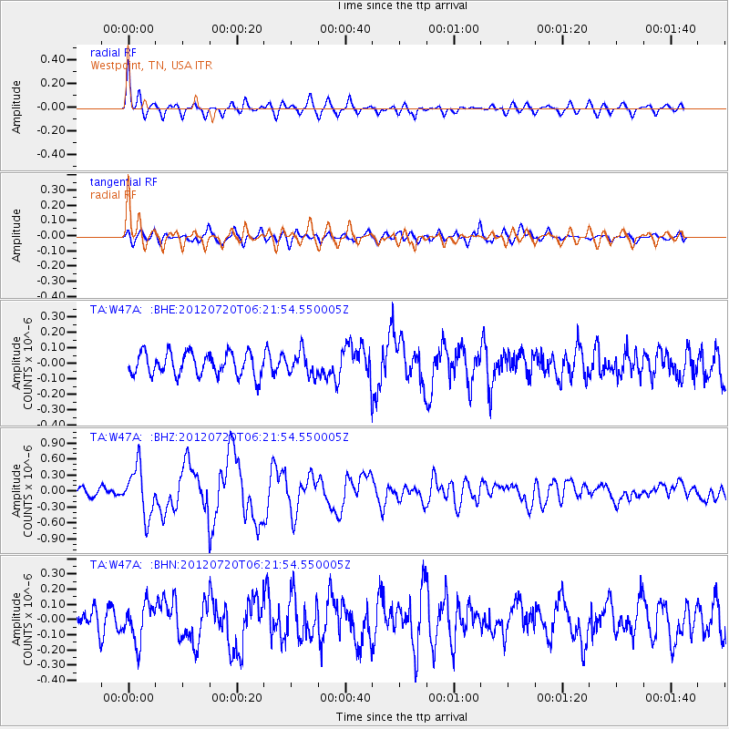
W47A Westpoint, TN, USA - Earthquake Result Viewer
*The percent match for this event was below the threshold and hence no stack was calculated.
| Earthquake location: |
Kuril Islands |
| Earthquake latitude/longitude: |
49.4/155.9 |
| Earthquake time(UTC): |
2012/07/20 (202) 06:10:25 GMT |
| Earthquake Depth: |
19 km |
| Earthquake Magnitude: |
5.7 MB, 5.7 MS, 6.0 MW, 6.1 MW |
| Earthquake Catalog/Contributor: |
WHDF/NEIC |
|
| Network: |
TA USArray Transportable Network (new EarthScope stations) |
| Station: |
W47A Westpoint, TN, USA |
| Lat/Lon: |
35.25 N/87.59 W |
| Elevation: |
293 m |
|
| Distance: |
78.7 deg |
| Az: |
48.335 deg |
| Baz: |
323.401 deg |
| Ray Param: |
$rayparam |
*The percent match for this event was below the threshold and hence was not used in the summary stack. |
|
| Radial Match: |
78.57815 % |
| Radial Bump: |
341 |
| Transverse Match: |
62.409065 % |
| Transverse Bump: |
400 |
| SOD ConfigId: |
469095 |
| Insert Time: |
2013-02-21 23:19:24.454 +0000 |
| GWidth: |
2.5 |
| Max Bumps: |
400 |
| Tol: |
0.001 |
|
Signal To Noise
| Channel | StoN | STA | LTA |
| TA:W47A: :BHZ:20120720T06:21:54.550005Z | 6.0464215 | 4.5918367E-7 | 7.594305E-8 |
| TA:W47A: :BHN:20120720T06:21:54.550005Z | 1.566576 | 1.2569622E-7 | 8.023627E-8 |
| TA:W47A: :BHE:20120720T06:21:54.550005Z | 1.0163218 | 7.4028904E-8 | 7.284003E-8 |
| Arrivals |
| Ps | |
| PpPs | |
| PsPs/PpSs | |


