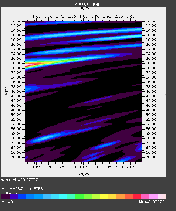
SSB2 Saint Sauveur Badole, France - Earthquake Result Viewer

Earthquake location: Andreanof Islands, Aleutian Is.
Earthquake latitude/longitude: 51.3/-178.1
Earthquake time(UTC): 1992/09/30 (274) 05:34:00 GMT
Earthquake Depth: 33 km
Earthquake Magnitude: 6.2 MB, 6.5 MS, 6.8 UNKNOWN, 5.8 ML
Earthquake Catalog/Contributor: WHDF/NEIC
Network: G GEOSCOPE
Station: SSB2 Saint Sauveur Badole, France
Lat/Lon: 45.28 N/4.54 E
Elevation: 700 m
Distance: 83.8 deg
Az: 358.148 deg
Baz: 1.648 deg
Ray Param: 0.045877773
Estimated Moho Depth: 28.5 km
Estimated Crust Vp/Vs: 1.60
Assumed Crust Vp: 6.1 km/s
Estimated Crust Vs: 3.812 km/s
Estimated Crust Poisson's Ratio: 0.18
Radial Match: 89.27077 %
Radial Bump: 387
Transverse Match: 66.70032 %
Transverse Bump: 400
SOD ConfigId: 16938
Insert Time: 2010-02-27 00:22:24.323 +0000
GWidth: 2.5
Max Bumps: 400
Tol: 0.001

Signal To Noise

ChannelStoNSTALTA
G:SSB2: :BHN:19920930T05:45:55.200024Z4.72992565.0192415E-71.0611671E-7
G:SSB2: :BHE:19920930T05:45:55.200024Z0.804470361.0499247E-71.3051131E-7
G:SSB2: :BHZ:19920930T05:45:55.200024Z9.0014791.426103E-61.5842986E-7
Arrivals
Ps2.9 SECOND
PpPs12 SECOND
PsPs/PpSs15 SECOND