You are here: Home > Network List > TA - USArray Transportable Network (new EarthScope stations) Stations List
> Station 254A Abbeville, GA, USA > Earthquake Result Viewer
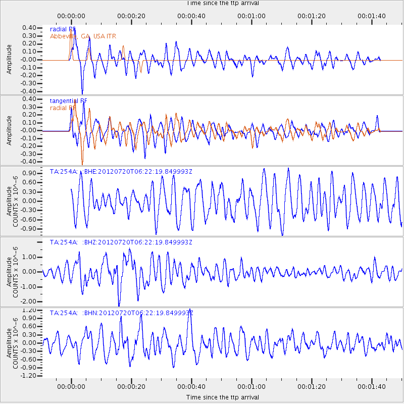
254A Abbeville, GA, USA - Earthquake Result Viewer
*The percent match for this event was below the threshold and hence no stack was calculated.
| Earthquake location: |
Kuril Islands |
| Earthquake latitude/longitude: |
49.4/155.9 |
| Earthquake time(UTC): |
2012/07/20 (202) 06:10:25 GMT |
| Earthquake Depth: |
19 km |
| Earthquake Magnitude: |
5.7 MB, 5.7 MS, 6.0 MW, 6.1 MW |
| Earthquake Catalog/Contributor: |
WHDF/NEIC |
|
| Network: |
TA USArray Transportable Network (new EarthScope stations) |
| Station: |
254A Abbeville, GA, USA |
| Lat/Lon: |
31.95 N/83.29 W |
| Elevation: |
78 m |
|
| Distance: |
83.4 deg |
| Az: |
47.31 deg |
| Baz: |
325.614 deg |
| Ray Param: |
$rayparam |
*The percent match for this event was below the threshold and hence was not used in the summary stack. |
|
| Radial Match: |
75.62354 % |
| Radial Bump: |
400 |
| Transverse Match: |
68.32097 % |
| Transverse Bump: |
400 |
| SOD ConfigId: |
469095 |
| Insert Time: |
2013-02-21 23:24:11.294 +0000 |
| GWidth: |
2.5 |
| Max Bumps: |
400 |
| Tol: |
0.001 |
|
Signal To Noise
| Channel | StoN | STA | LTA |
| TA:254A: :BHZ:20120720T06:22:19.849993Z | 3.8428671 | 7.6252695E-7 | 1.9842658E-7 |
| TA:254A: :BHN:20120720T06:22:19.849993Z | 1.0058181 | 3.1748718E-7 | 3.1565068E-7 |
| TA:254A: :BHE:20120720T06:22:19.849993Z | 1.3609965 | 4.865652E-7 | 3.575066E-7 |
| Arrivals |
| Ps | |
| PpPs | |
| PsPs/PpSs | |


