
KMNB KING-MEN - Earthquake Result Viewer
| ||||||||||||||||||
| ||||||||||||||||||
| ||||||||||||||||||
|

Signal To Noise
| Channel | StoN | STA | LTA |
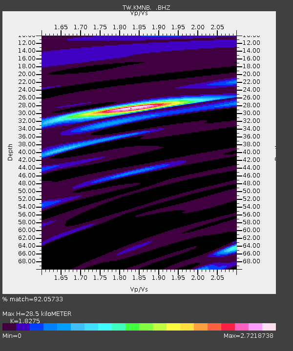
| TW:KMNB: :BHZ:20120720T06:17:14.319994Z | 4.356653 | 7.443863E-7 | 1.7086195E-7 |
| TW:KMNB: :BHN:20120720T06:17:14.319994Z | 3.3563576 | 7.570532E-7 | 2.2555797E-7 |
| TW:KMNB: :BHE:20120720T06:17:14.319994Z | 2.363149 | 5.4148353E-7 | 2.2913643E-7 |
| Arrivals | |
| Ps | 3.9 SECOND |
| PpPs | 12 SECOND |
| PsPs/PpSs | 16 SECOND |

