You are here: Home > Network List > UW - Pacific Northwest Regional Seismic Network Stations List
> Station LEBA Lebam, WA, USA > Earthquake Result Viewer
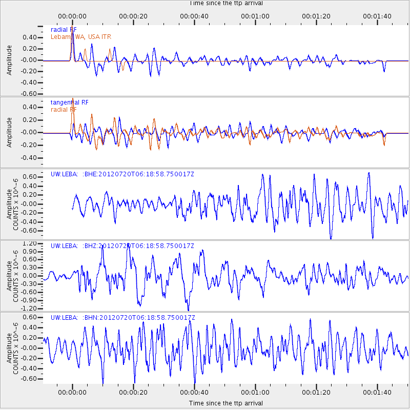
LEBA Lebam, WA, USA - Earthquake Result Viewer
*The percent match for this event was below the threshold and hence no stack was calculated.
| Earthquake location: |
Kuril Islands |
| Earthquake latitude/longitude: |
49.4/155.9 |
| Earthquake time(UTC): |
2012/07/20 (202) 06:10:25 GMT |
| Earthquake Depth: |
19 km |
| Earthquake Magnitude: |
5.7 MB, 5.7 MS, 6.0 MW, 6.1 MW |
| Earthquake Catalog/Contributor: |
WHDF/NEIC |
|
| Network: |
UW Pacific Northwest Regional Seismic Network |
| Station: |
LEBA Lebam, WA, USA |
| Lat/Lon: |
46.55 N/123.56 W |
| Elevation: |
73 m |
|
| Distance: |
51.5 deg |
| Az: |
60.404 deg |
| Baz: |
304.622 deg |
| Ray Param: |
$rayparam |
*The percent match for this event was below the threshold and hence was not used in the summary stack. |
|
| Radial Match: |
71.50986 % |
| Radial Bump: |
400 |
| Transverse Match: |
71.32111 % |
| Transverse Bump: |
400 |
| SOD ConfigId: |
469095 |
| Insert Time: |
2013-02-21 23:31:08.714 +0000 |
| GWidth: |
2.5 |
| Max Bumps: |
400 |
| Tol: |
0.001 |
|
Signal To Noise
| Channel | StoN | STA | LTA |
| UW:LEBA: :BHZ:20120720T06:18:58.750017Z | 2.4670854 | 2.4335384E-7 | 9.8640214E-8 |
| UW:LEBA: :BHN:20120720T06:18:58.750017Z | 1.1622356 | 2.1067027E-7 | 1.8126296E-7 |
| UW:LEBA: :BHE:20120720T06:18:58.750017Z | 0.74523234 | 1.01684236E-7 | 1.3644635E-7 |
| Arrivals |
| Ps | |
| PpPs | |
| PsPs/PpSs | |


