You are here: Home > Network List > G - GEOSCOPE Stations List
> Station ATD Arta Cave - Arta, Republic of Djibouti > Earthquake Result Viewer
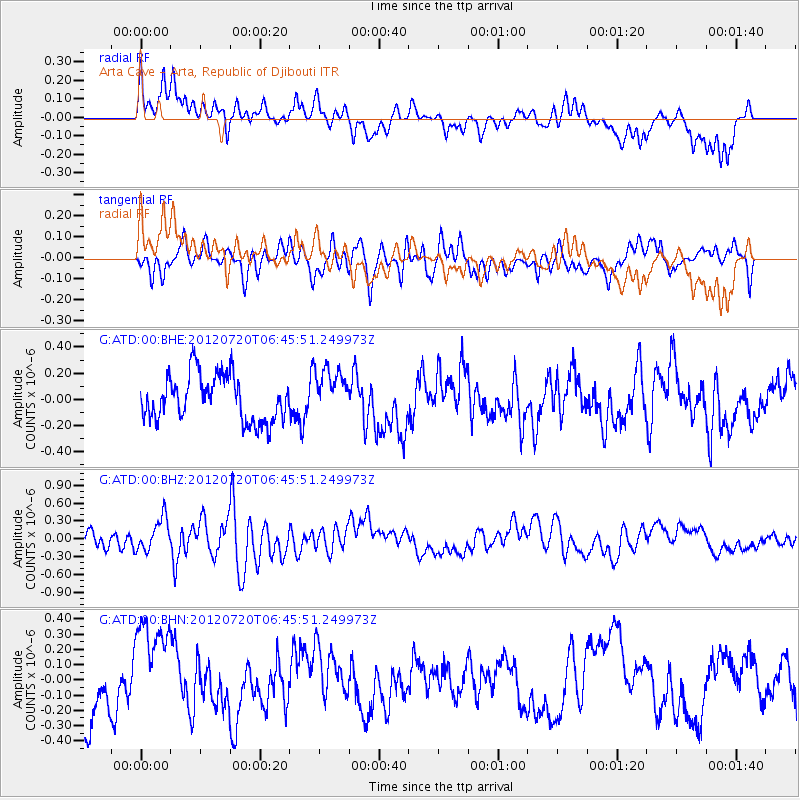
ATD Arta Cave - Arta, Republic of Djibouti - Earthquake Result Viewer
*The percent match for this event was below the threshold and hence no stack was calculated.
| Earthquake location: |
Kuril Islands |
| Earthquake latitude/longitude: |
49.4/156.1 |
| Earthquake time(UTC): |
2012/07/20 (202) 06:32:56 GMT |
| Earthquake Depth: |
10 km |
| Earthquake Magnitude: |
5.8 MB, 5.5 MS, 5.8 MW, 5.9 MW |
| Earthquake Catalog/Contributor: |
WHDF/NEIC |
|
| Network: |
G GEOSCOPE |
| Station: |
ATD Arta Cave - Arta, Republic of Djibouti |
| Lat/Lon: |
11.53 N/42.85 E |
| Elevation: |
610 m |
|
| Distance: |
95.9 deg |
| Az: |
295.167 deg |
| Baz: |
37.146 deg |
| Ray Param: |
$rayparam |
*The percent match for this event was below the threshold and hence was not used in the summary stack. |
|
| Radial Match: |
55.825382 % |
| Radial Bump: |
400 |
| Transverse Match: |
51.054993 % |
| Transverse Bump: |
400 |
| SOD ConfigId: |
469095 |
| Insert Time: |
2013-02-21 23:36:59.277 +0000 |
| GWidth: |
2.5 |
| Max Bumps: |
400 |
| Tol: |
0.001 |
|
Signal To Noise
| Channel | StoN | STA | LTA |
| G:ATD:00:BHZ:20120720T06:45:51.249973Z | 2.6159966 | 2.745217E-7 | 1.0493964E-7 |
| G:ATD:00:BHN:20120720T06:45:51.249973Z | 2.2470744 | 3.3554758E-7 | 1.4932643E-7 |
| G:ATD:00:BHE:20120720T06:45:51.249973Z | 1.0463365 | 1.8254381E-7 | 1.7445996E-7 |
| Arrivals |
| Ps | |
| PpPs | |
| PsPs/PpSs | |


