You are here: Home > Network List > TA - USArray Transportable Network (new EarthScope stations) Stations List
> Station V50A Pikevile, TN, USA > Earthquake Result Viewer
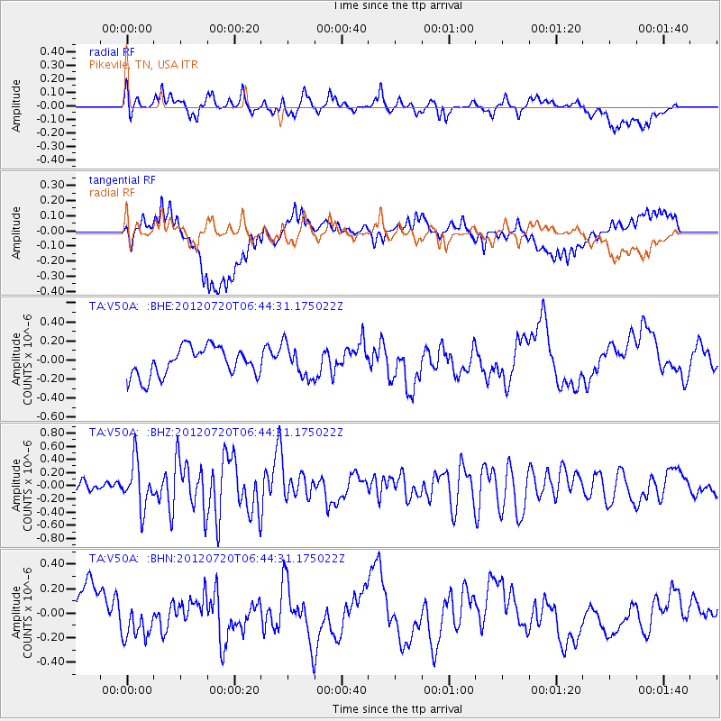
V50A Pikevile, TN, USA - Earthquake Result Viewer
*The percent match for this event was below the threshold and hence no stack was calculated.
| Earthquake location: |
Kuril Islands |
| Earthquake latitude/longitude: |
49.4/156.1 |
| Earthquake time(UTC): |
2012/07/20 (202) 06:32:56 GMT |
| Earthquake Depth: |
10 km |
| Earthquake Magnitude: |
5.8 MB, 5.5 MS, 5.8 MW, 5.9 MW |
| Earthquake Catalog/Contributor: |
WHDF/NEIC |
|
| Network: |
TA USArray Transportable Network (new EarthScope stations) |
| Station: |
V50A Pikevile, TN, USA |
| Lat/Lon: |
35.67 N/85.10 W |
| Elevation: |
287 m |
|
| Distance: |
79.5 deg |
| Az: |
46.551 deg |
| Baz: |
324.335 deg |
| Ray Param: |
$rayparam |
*The percent match for this event was below the threshold and hence was not used in the summary stack. |
|
| Radial Match: |
56.35221 % |
| Radial Bump: |
400 |
| Transverse Match: |
56.59946 % |
| Transverse Bump: |
400 |
| SOD ConfigId: |
469095 |
| Insert Time: |
2013-02-22 00:04:50.887 +0000 |
| GWidth: |
2.5 |
| Max Bumps: |
400 |
| Tol: |
0.001 |
|
Signal To Noise
| Channel | StoN | STA | LTA |
| TA:V50A: :BHZ:20120720T06:44:31.175022Z | 3.6603806 | 3.5246336E-7 | 9.629145E-8 |
| TA:V50A: :BHN:20120720T06:44:31.175022Z | 1.2628579 | 1.6893084E-7 | 1.3376868E-7 |
| TA:V50A: :BHE:20120720T06:44:31.175022Z | 1.1208823 | 1.6826759E-7 | 1.5012067E-7 |
| Arrivals |
| Ps | |
| PpPs | |
| PsPs/PpSs | |


