You are here: Home > Network List > AZ - ANZA Regional Network Stations List
> Station SMER AZ.SMER > Earthquake Result Viewer
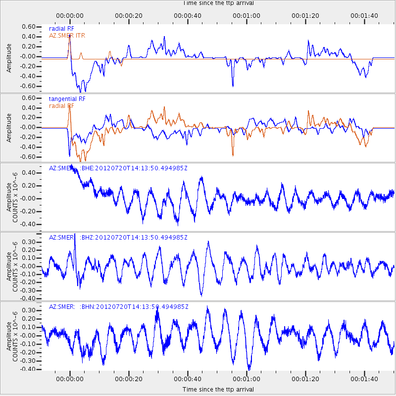
SMER AZ.SMER - Earthquake Result Viewer
*The percent match for this event was below the threshold and hence no stack was calculated.
| Earthquake location: |
Fiji Islands Region |
| Earthquake latitude/longitude: |
-21.2/-179.3 |
| Earthquake time(UTC): |
2012/07/20 (202) 14:03:13 GMT |
| Earthquake Depth: |
625 km |
| Earthquake Magnitude: |
5.6 MB, 5.6 MW, 5.5 MW |
| Earthquake Catalog/Contributor: |
WHDF/NEIC |
|
| Network: |
AZ ANZA Regional Network |
| Station: |
SMER AZ.SMER |
| Lat/Lon: |
33.46 N/117.17 W |
| Elevation: |
355 m |
|
| Distance: |
80.4 deg |
| Az: |
48.547 deg |
| Baz: |
236.769 deg |
| Ray Param: |
$rayparam |
*The percent match for this event was below the threshold and hence was not used in the summary stack. |
|
| Radial Match: |
45.846077 % |
| Radial Bump: |
400 |
| Transverse Match: |
59.765453 % |
| Transverse Bump: |
400 |
| SOD ConfigId: |
469095 |
| Insert Time: |
2013-02-22 00:11:33.880 +0000 |
| GWidth: |
2.5 |
| Max Bumps: |
400 |
| Tol: |
0.001 |
|
Signal To Noise
| Channel | StoN | STA | LTA |
| AZ:SMER: :BHZ:20120720T14:13:50.494985Z | 1.560411 | 1.5951277E-7 | 1.02224845E-7 |
| AZ:SMER: :BHN:20120720T14:13:50.494985Z | 1.9009571 | 1.8097232E-7 | 9.520063E-8 |
| AZ:SMER: :BHE:20120720T14:13:50.494985Z | 1.3611859 | 2.479983E-7 | 1.821928E-7 |
| Arrivals |
| Ps | |
| PpPs | |
| PsPs/PpSs | |


