You are here: Home > Network List > CI - Caltech Regional Seismic Network Stations List
> Station GLA Glamis, Glamis, CA, USA > Earthquake Result Viewer
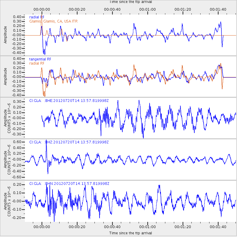
GLA Glamis, Glamis, CA, USA - Earthquake Result Viewer
*The percent match for this event was below the threshold and hence no stack was calculated.
| Earthquake location: |
Fiji Islands Region |
| Earthquake latitude/longitude: |
-21.2/-179.3 |
| Earthquake time(UTC): |
2012/07/20 (202) 14:03:13 GMT |
| Earthquake Depth: |
625 km |
| Earthquake Magnitude: |
5.6 MB, 5.6 MW, 5.5 MW |
| Earthquake Catalog/Contributor: |
WHDF/NEIC |
|
| Network: |
CI Caltech Regional Seismic Network |
| Station: |
GLA Glamis, Glamis, CA, USA |
| Lat/Lon: |
33.05 N/114.83 W |
| Elevation: |
610 m |
|
| Distance: |
81.8 deg |
| Az: |
49.96 deg |
| Baz: |
238.267 deg |
| Ray Param: |
$rayparam |
*The percent match for this event was below the threshold and hence was not used in the summary stack. |
|
| Radial Match: |
66.65312 % |
| Radial Bump: |
400 |
| Transverse Match: |
54.997887 % |
| Transverse Bump: |
400 |
| SOD ConfigId: |
469095 |
| Insert Time: |
2013-02-22 00:12:27.277 +0000 |
| GWidth: |
2.5 |
| Max Bumps: |
400 |
| Tol: |
0.001 |
|
Signal To Noise
| Channel | StoN | STA | LTA |
| CI:GLA: :BHZ:20120720T14:13:57.819998Z | 2.5393178 | 2.0647155E-7 | 8.130985E-8 |
| CI:GLA: :BHN:20120720T14:13:57.819998Z | 1.8388422 | 8.619774E-8 | 4.6876092E-8 |
| CI:GLA: :BHE:20120720T14:13:57.819998Z | 1.3131605 | 9.505669E-8 | 7.238772E-8 |
| Arrivals |
| Ps | |
| PpPs | |
| PsPs/PpSs | |


