You are here: Home > Network List > TA - USArray Transportable Network (new EarthScope stations) Stations List
> Station TPFO Pinon Flats, CA, USA > Earthquake Result Viewer
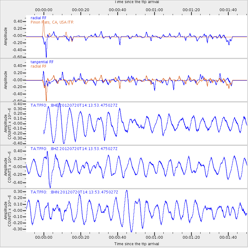
TPFO Pinon Flats, CA, USA - Earthquake Result Viewer
*The percent match for this event was below the threshold and hence no stack was calculated.
| Earthquake location: |
Fiji Islands Region |
| Earthquake latitude/longitude: |
-21.2/-179.3 |
| Earthquake time(UTC): |
2012/07/20 (202) 14:03:13 GMT |
| Earthquake Depth: |
625 km |
| Earthquake Magnitude: |
5.6 MB, 5.6 MW, 5.5 MW |
| Earthquake Catalog/Contributor: |
WHDF/NEIC |
|
| Network: |
TA USArray Transportable Network (new EarthScope stations) |
| Station: |
TPFO Pinon Flats, CA, USA |
| Lat/Lon: |
33.61 N/116.45 W |
| Elevation: |
1275 m |
|
| Distance: |
81.0 deg |
| Az: |
48.751 deg |
| Baz: |
237.196 deg |
| Ray Param: |
$rayparam |
*The percent match for this event was below the threshold and hence was not used in the summary stack. |
|
| Radial Match: |
66.90762 % |
| Radial Bump: |
331 |
| Transverse Match: |
65.62848 % |
| Transverse Bump: |
400 |
| SOD ConfigId: |
469095 |
| Insert Time: |
2013-02-22 00:15:54.935 +0000 |
| GWidth: |
2.5 |
| Max Bumps: |
400 |
| Tol: |
0.001 |
|
Signal To Noise
| Channel | StoN | STA | LTA |
| TA:TPFO: :BHZ:20120720T14:13:53.475027Z | 1.9262455 | 2.8459164E-7 | 1.4774422E-7 |
| TA:TPFO: :BHN:20120720T14:13:53.475027Z | 1.0118043 | 9.123143E-8 | 9.016707E-8 |
| TA:TPFO: :BHE:20120720T14:13:53.475027Z | 0.6877876 | 1.590222E-7 | 2.3120832E-7 |
| Arrivals |
| Ps | |
| PpPs | |
| PsPs/PpSs | |


