You are here: Home > Network List > AZ - ANZA Regional Network Stations List
> Station SMER AZ.SMER > Earthquake Result Viewer
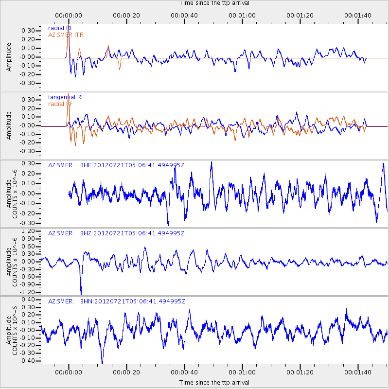
SMER AZ.SMER - Earthquake Result Viewer
*The percent match for this event was below the threshold and hence no stack was calculated.
| Earthquake location: |
East Of North Island, N.Z. |
| Earthquake latitude/longitude: |
-37.7/-180.0 |
| Earthquake time(UTC): |
2012/07/21 (203) 04:54:05 GMT |
| Earthquake Depth: |
12 km |
| Earthquake Magnitude: |
5.7 MB, 5.5 MS, 5.6 MW, 5.7 MW |
| Earthquake Catalog/Contributor: |
WHDF/NEIC |
|
| Network: |
AZ ANZA Regional Network |
| Station: |
SMER AZ.SMER |
| Lat/Lon: |
33.46 N/117.17 W |
| Elevation: |
355 m |
|
| Distance: |
91.8 deg |
| Az: |
48.064 deg |
| Baz: |
224.885 deg |
| Ray Param: |
$rayparam |
*The percent match for this event was below the threshold and hence was not used in the summary stack. |
|
| Radial Match: |
59.45763 % |
| Radial Bump: |
400 |
| Transverse Match: |
59.547756 % |
| Transverse Bump: |
400 |
| SOD ConfigId: |
469095 |
| Insert Time: |
2013-02-22 00:19:48.133 +0000 |
| GWidth: |
2.5 |
| Max Bumps: |
400 |
| Tol: |
0.001 |
|
Signal To Noise
| Channel | StoN | STA | LTA |
| AZ:SMER: :BHZ:20120721T05:06:41.494995Z | 2.2858796 | 3.581502E-7 | 1.5667939E-7 |
| AZ:SMER: :BHN:20120721T05:06:41.494995Z | 1.3537248 | 9.074682E-8 | 6.703491E-8 |
| AZ:SMER: :BHE:20120721T05:06:41.494995Z | 2.0419192 | 1.00973374E-7 | 4.9450232E-8 |
| Arrivals |
| Ps | |
| PpPs | |
| PsPs/PpSs | |


