You are here: Home > Network List > TA - USArray Transportable Network (new EarthScope stations) Stations List
> Station MSTX Muleshoe, TX, USA > Earthquake Result Viewer
MSTX Muleshoe, TX, USA - Earthquake Result Viewer
*The percent match for this event was below the threshold and hence no stack was calculated.
| Earthquake location: |
Komandorskiye Ostrova Region |
| Earthquake latitude/longitude: |
55.0/165.7 |
| Earthquake time(UTC): |
2014/05/31 (151) 06:16:56 GMT |
| Earthquake Depth: |
20 km |
| Earthquake Magnitude: |
5.5 MW |
| Earthquake Catalog/Contributor: |
ISC/ISC |
|
| Network: |
TA USArray Transportable Network (new EarthScope stations) |
| Station: |
MSTX Muleshoe, TX, USA |
| Lat/Lon: |
33.97 N/102.77 W |
| Elevation: |
1167 m |
|
| Distance: |
63.8 deg |
| Az: |
67.819 deg |
| Baz: |
320.053 deg |
| Ray Param: |
$rayparam |
*The percent match for this event was below the threshold and hence was not used in the summary stack. |
|
| Radial Match: |
49.346935 % |
| Radial Bump: |
400 |
| Transverse Match: |
44.86267 % |
| Transverse Bump: |
400 |
| SOD ConfigId: |
3390531 |
| Insert Time: |
2019-04-12 02:52:04.513 +0000 |
| GWidth: |
2.5 |
| Max Bumps: |
400 |
| Tol: |
0.001 |
|
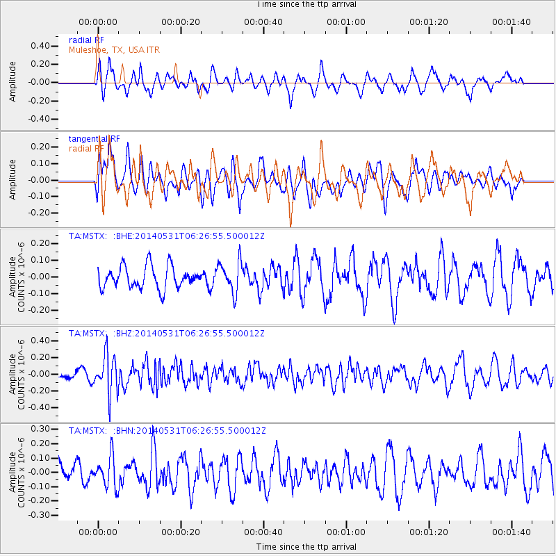
Signal To Noise
| Channel | StoN | STA | LTA |
| TA:MSTX: :BHZ:20140531T06:26:55.500012Z | 3.7732692 | 2.347402E-7 | 6.221136E-8 |
| TA:MSTX: :BHN:20140531T06:26:55.500012Z | 1.1556647 | 1.1262582E-7 | 9.745545E-8 |
| TA:MSTX: :BHE:20140531T06:26:55.500012Z | 1.4334793 | 9.421021E-8 | 6.572136E-8 |
| Arrivals |
| Ps | |
| PpPs | |
| PsPs/PpSs | |


