You are here: Home > Network List > TA - USArray Transportable Network (new EarthScope stations) Stations List
> Station M04C Macdoel, CA, USA > Earthquake Result Viewer
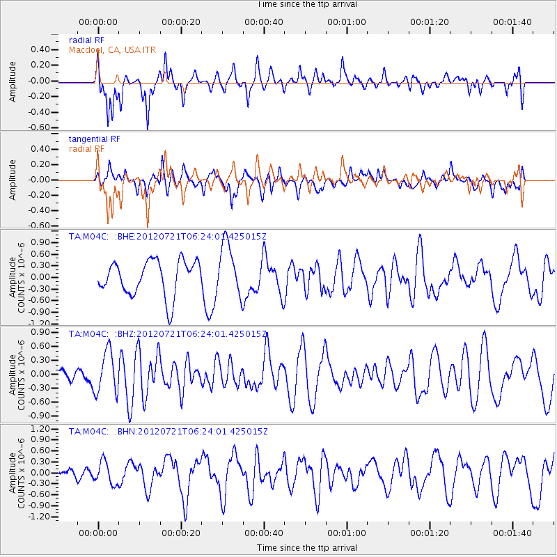
M04C Macdoel, CA, USA - Earthquake Result Viewer
*The percent match for this event was below the threshold and hence no stack was calculated.
| Earthquake location: |
Vanuatu Islands Region |
| Earthquake latitude/longitude: |
-19.2/173.8 |
| Earthquake time(UTC): |
2012/07/21 (203) 06:11:57 GMT |
| Earthquake Depth: |
10 km |
| Earthquake Magnitude: |
5.5 MB, 5.5 MS, 5.9 MW, 5.8 MW |
| Earthquake Catalog/Contributor: |
WHDF/NEIC |
|
| Network: |
TA USArray Transportable Network (new EarthScope stations) |
| Station: |
M04C Macdoel, CA, USA |
| Lat/Lon: |
41.78 N/121.84 W |
| Elevation: |
1391 m |
|
| Distance: |
84.9 deg |
| Az: |
42.609 deg |
| Baz: |
238.817 deg |
| Ray Param: |
$rayparam |
*The percent match for this event was below the threshold and hence was not used in the summary stack. |
|
| Radial Match: |
77.172134 % |
| Radial Bump: |
400 |
| Transverse Match: |
46.83822 % |
| Transverse Bump: |
400 |
| SOD ConfigId: |
469095 |
| Insert Time: |
2013-02-22 00:27:57.852 +0000 |
| GWidth: |
2.5 |
| Max Bumps: |
400 |
| Tol: |
0.001 |
|
Signal To Noise
| Channel | StoN | STA | LTA |
| TA:M04C: :BHZ:20120721T06:24:01.425015Z | 1.2036371 | 4.5900475E-7 | 3.8134812E-7 |
| TA:M04C: :BHN:20120721T06:24:01.425015Z | 0.6074861 | 3.1124497E-7 | 5.1234906E-7 |
| TA:M04C: :BHE:20120721T06:24:01.425015Z | 1.5489486 | 6.9797E-7 | 4.5060887E-7 |
| Arrivals |
| Ps | |
| PpPs | |
| PsPs/PpSs | |


