TAM Tamanrasset, Algeria - Earthquake Result Viewer
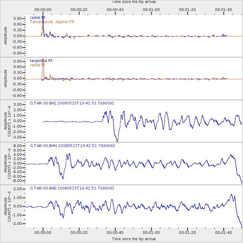
Earthquake location: Central Mid-Atlantic Ridge
Earthquake latitude/longitude: 7.3/-34.9
Earthquake time(UTC): 2008/05/23 (144) 19:35:34 GMT
Earthquake Depth: 9.0 km
Earthquake Magnitude: 6.0 MB, 6.4 MS, 6.5 MW, 6.5 MW
Earthquake Catalog/Contributor: WHDF/NEIC
Network: G GEOSCOPE
Station: TAM Tamanrasset, Algeria
Lat/Lon: 22.79 N/5.53 E
Elevation: 1377 m
Distance: 41.8 deg
Az: 63.894 deg
Baz: 254.85 deg
Ray Param: 0.07357205
Estimated Moho Depth: 38.25 km
Estimated Crust Vp/Vs: 1.66
Assumed Crust Vp: 6.61 km/s
Estimated Crust Vs: 3.976 km/s
Estimated Crust Poisson's Ratio: 0.22
Radial Match: 97.16089 %
Radial Bump: 266
Transverse Match: 79.52477 %
Transverse Bump: 400
SOD ConfigId: 2504
Insert Time: 2010-02-27 00:23:29.141 +0000
GWidth: 2.5
Max Bumps: 400
Tol: 0.001

Signal To Noise

ChannelStoNSTALTA
G:TAM:00:BHN:20080523T19:42:53.799009Z17.2655141.2378288E-67.169371E-8
G:TAM:00:BHE:20080523T19:42:53.799009Z6.44957352.7372386E-74.2440615E-8
G:TAM:00:BHZ:20080523T19:42:53.799009Z18.610776.671599E-73.5848057E-8
Arrivals
Ps4.1 SECOND
PpPs14 SECOND
PsPs/PpSs18 SECOND