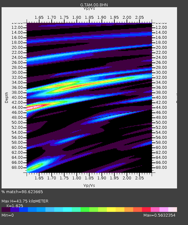
TAM Tamanrasset, Algeria - Earthquake Result Viewer
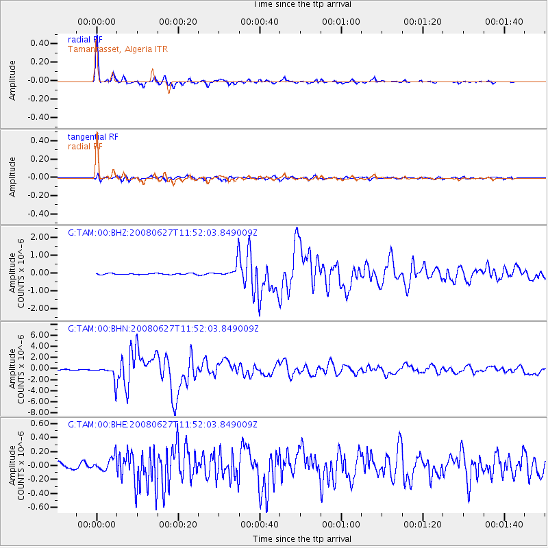
Earthquake location: Andaman Islands, India Region
Earthquake latitude/longitude: 11.0/91.8
Earthquake time(UTC): 2008/06/27 (179) 11:40:13 GMT
Earthquake Depth: 17 km
Earthquake Magnitude: 6.4 MB, 6.7 MS, 6.6 MW, 6.6 MW
Earthquake Catalog/Contributor: WHDF/NEIC
Network: G GEOSCOPE
Station: TAM Tamanrasset, Algeria
Lat/Lon: 22.79 N/5.53 E
Elevation: 1377 m
Distance: 82.4 deg
Az: 291.721 deg
Baz: 81.261 deg
Ray Param: 0.046873774
Estimated Moho Depth: 43.75 km
Estimated Crust Vp/Vs: 1.62
Assumed Crust Vp: 6.61 km/s
Estimated Crust Vs: 4.068 km/s
Estimated Crust Poisson's Ratio: 0.20
Radial Match: 98.623665 %
Radial Bump: 218
Transverse Match: 89.18092 %
Transverse Bump: 400
SOD ConfigId: 2504
Insert Time: 2010-02-27 00:23:31.830 +0000
GWidth: 2.5
Max Bumps: 400
Tol: 0.001

Signal To Noise

ChannelStoNSTALTA
G:TAM:00:BHN:20080627T11:52:03.849009Z23.9397011.5016063E-66.2724524E-8
G:TAM:00:BHE:20080627T11:52:03.849009Z1.92999651.0357886E-75.3667904E-8
G:TAM:00:BHZ:20080627T11:52:03.849009Z15.318844.791521E-73.1278617E-8
Arrivals
Ps4.3 SECOND
PpPs17 SECOND
PsPs/PpSs21 SECOND