MDJ Mudanjiang, Heilongjiang Province, China - Earthquake Result Viewer
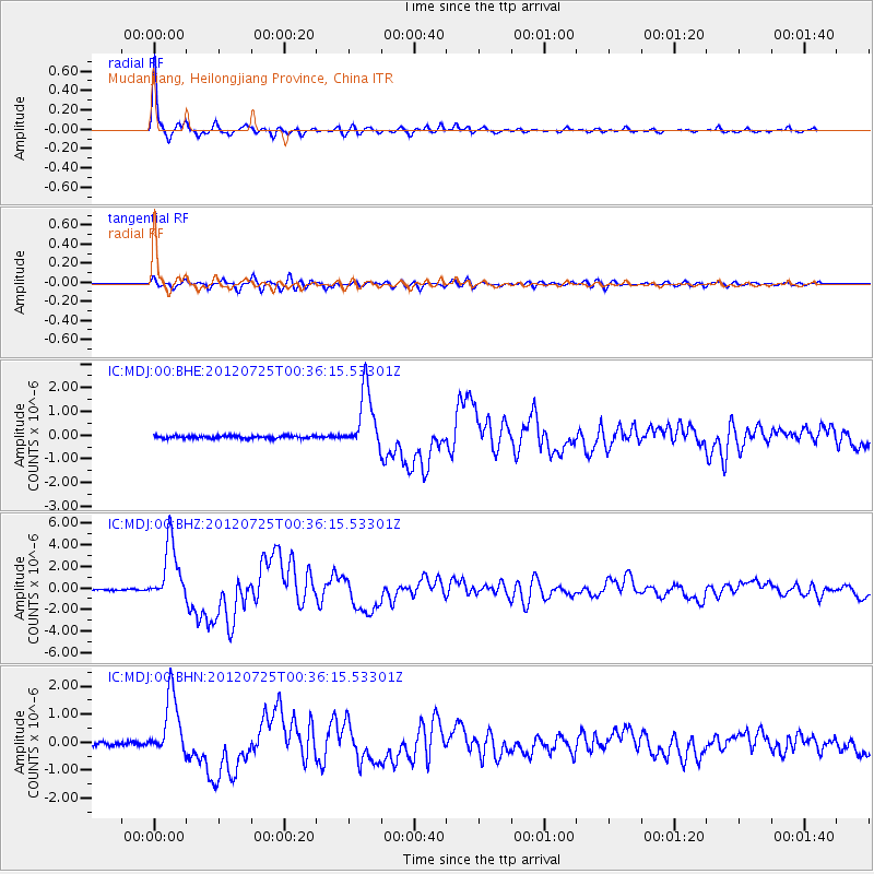
Earthquake location: Northern Sumatra, Indonesia
Earthquake latitude/longitude: 2.7/96.0
Earthquake time(UTC): 2012/07/25 (207) 00:27:45 GMT
Earthquake Depth: 22 km
Earthquake Magnitude: 5.9 MB, 6.5 MS, 6.4 MW, 6.3 MW
Earthquake Catalog/Contributor: WHDF/NEIC
Network: IC New China Digital Seismograph Network
Station: MDJ Mudanjiang, Heilongjiang Province, China
Lat/Lon: 44.62 N/129.59 E
Elevation: 270 m
Distance: 51.1 deg
Az: 30.452 deg
Baz: 225.143 deg
Ray Param: 0.06757028
Estimated Moho Depth: 32.25 km
Estimated Crust Vp/Vs: 1.90
Assumed Crust Vp: 6.459 km/s
Estimated Crust Vs: 3.4 km/s
Estimated Crust Poisson's Ratio: 0.31
Radial Match: 98.15702 %
Radial Bump: 307
Transverse Match: 88.18763 %
Transverse Bump: 400
SOD ConfigId: 469095
Insert Time: 2013-02-22 00:36:57.821 +0000
GWidth: 2.5
Max Bumps: 400
Tol: 0.001

Signal To Noise

ChannelStoNSTALTA
IC:MDJ:00:BHZ:20120725T00:36:15.53301Z47.7559472.7862143E-65.834277E-8
IC:MDJ:00:BHN:20120725T00:36:15.53301Z18.678161.1085122E-65.934804E-8
IC:MDJ:00:BHE:20120725T00:36:15.53301Z22.4787751.276918E-65.68055E-8
Arrivals
Ps4.7 SECOND
PpPs14 SECOND
PsPs/PpSs18 SECOND