TOLK Toolik Lake Research Station, AK, USA - Earthquake Result Viewer
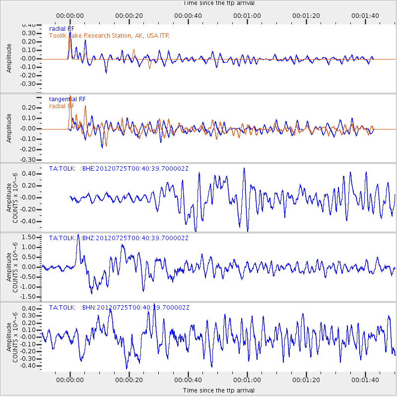
Earthquake location: Northern Sumatra, Indonesia
Earthquake latitude/longitude: 2.7/96.0
Earthquake time(UTC): 2012/07/25 (207) 00:27:45 GMT
Earthquake Depth: 22 km
Earthquake Magnitude: 5.9 MB, 6.5 MS, 6.4 MW, 6.3 MW
Earthquake Catalog/Contributor: WHDF/NEIC
Network: TA USArray Transportable Network (new EarthScope stations)
Station: TOLK Toolik Lake Research Station, AK, USA
Lat/Lon: 68.64 N/149.57 W
Elevation: 760 m
Distance: 96.2 deg
Az: 19.609 deg
Baz: 293.78 deg
Ray Param: 0.04058176
Estimated Moho Depth: 10.75 km
Estimated Crust Vp/Vs: 2.10
Assumed Crust Vp: 6.316 km/s
Estimated Crust Vs: 3.011 km/s
Estimated Crust Poisson's Ratio: 0.35
Radial Match: 81.9496 %
Radial Bump: 375
Transverse Match: 76.61035 %
Transverse Bump: 400
SOD ConfigId: 469095
Insert Time: 2013-02-22 00:39:28.570 +0000
GWidth: 2.5
Max Bumps: 400
Tol: 0.001

Signal To Noise

ChannelStoNSTALTA
TA:TOLK: :BHZ:20120725T00:40:39.700002Z9.4108266.7732924E-77.197341E-8
TA:TOLK: :BHN:20120725T00:40:39.700002Z1.84232891.5421325E-78.370561E-8
TA:TOLK: :BHE:20120725T00:40:39.700002Z3.94347951.6416686E-74.1629953E-8
Arrivals
Ps1.9 SECOND
PpPs5.2 SECOND
PsPs/PpSs7.1 SECOND