TAM Tamanrasset, Algeria - Earthquake Result Viewer
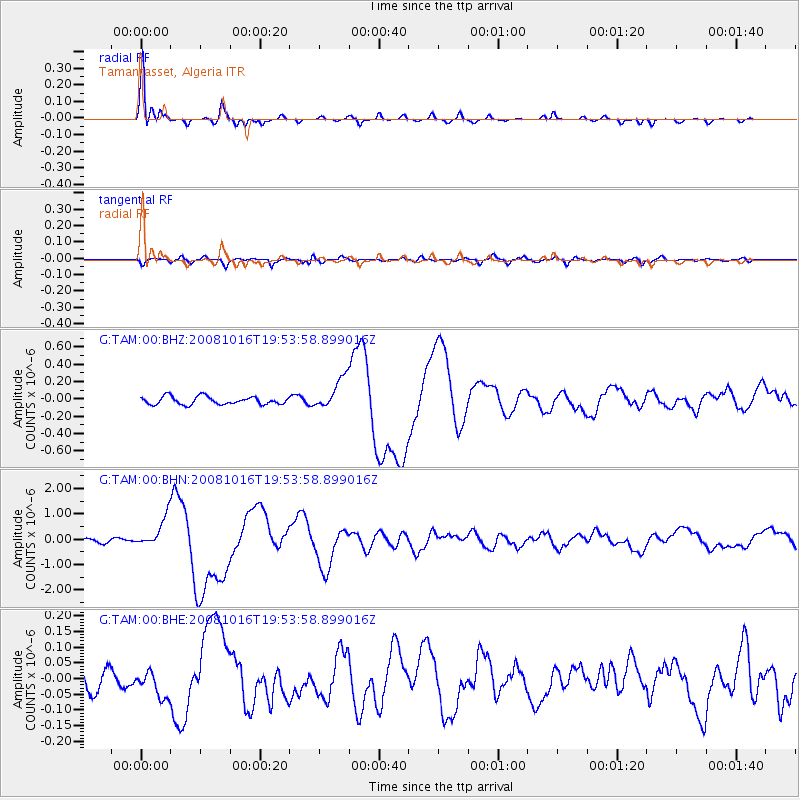
Earthquake location: Near Coast Of Chiapas, Mexico
Earthquake latitude/longitude: 14.4/-92.4
Earthquake time(UTC): 2008/10/16 (290) 19:41:25 GMT
Earthquake Depth: 24 km
Earthquake Magnitude: 6.1 MB, 6.6 MS, 6.7 MW, 6.6 MW
Earthquake Catalog/Contributor: WHDF/NEIC
Network: G GEOSCOPE
Station: TAM Tamanrasset, Algeria
Lat/Lon: 22.79 N/5.53 E
Elevation: 1377 m
Distance: 91.6 deg
Az: 66.128 deg
Baz: 286.246 deg
Ray Param: 0.041584596
Estimated Moho Depth: 33.25 km
Estimated Crust Vp/Vs: 1.79
Assumed Crust Vp: 6.61 km/s
Estimated Crust Vs: 3.693 km/s
Estimated Crust Poisson's Ratio: 0.27
Radial Match: 96.62121 %
Radial Bump: 325
Transverse Match: 77.93844 %
Transverse Bump: 400
SOD ConfigId: 2556
Insert Time: 2010-02-27 00:24:02.990 +0000
GWidth: 2.5
Max Bumps: 400
Tol: 0.001

Signal To Noise

ChannelStoNSTALTA
G:TAM:00:BHN:20081016T19:53:58.899016Z10.4751766.033892E-75.760182E-8
G:TAM:00:BHE:20081016T19:53:58.899016Z0.91592344.2901863E-84.684001E-8
G:TAM:00:BHZ:20081016T19:53:58.899016Z4.0385771.8102588E-74.4824176E-8
Arrivals
Ps4.1 SECOND
PpPs14 SECOND
PsPs/PpSs18 SECOND