You are here: Home > Network List > UW - Pacific Northwest Regional Seismic Network Stations List
> Station UMAT Pilot Rock, OR, USA > Earthquake Result Viewer
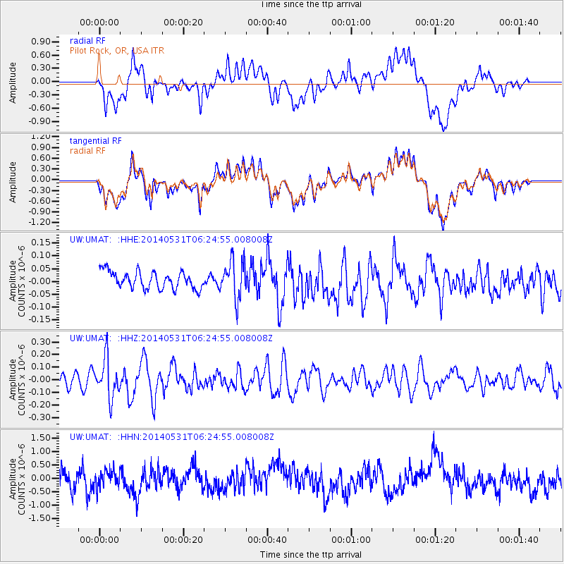
UMAT Pilot Rock, OR, USA - Earthquake Result Viewer
*The percent match for this event was below the threshold and hence no stack was calculated.
| Earthquake location: |
Komandorskiye Ostrova Region |
| Earthquake latitude/longitude: |
55.0/165.7 |
| Earthquake time(UTC): |
2014/05/31 (151) 06:16:56 GMT |
| Earthquake Depth: |
20 km |
| Earthquake Magnitude: |
5.5 MW |
| Earthquake Catalog/Contributor: |
ISC/ISC |
|
| Network: |
UW Pacific Northwest Regional Seismic Network |
| Station: |
UMAT Pilot Rock, OR, USA |
| Lat/Lon: |
45.29 N/118.96 W |
| Elevation: |
1318 m |
|
| Distance: |
47.0 deg |
| Az: |
68.993 deg |
| Baz: |
310.351 deg |
| Ray Param: |
$rayparam |
*The percent match for this event was below the threshold and hence was not used in the summary stack. |
|
| Radial Match: |
50.319042 % |
| Radial Bump: |
400 |
| Transverse Match: |
48.56724 % |
| Transverse Bump: |
400 |
| SOD ConfigId: |
3390531 |
| Insert Time: |
2019-04-12 02:55:00.506 +0000 |
| GWidth: |
2.5 |
| Max Bumps: |
400 |
| Tol: |
0.001 |
|
Signal To Noise
| Channel | StoN | STA | LTA |
| UW:UMAT: :HHZ:20140531T06:24:55.008008Z | 3.2989507 | 1.5490116E-7 | 4.695468E-8 |
| UW:UMAT: :HHN:20140531T06:24:55.008008Z | 0.8165426 | 2.920594E-7 | 3.576781E-7 |
| UW:UMAT: :HHE:20140531T06:24:55.008008Z | 2.2862103 | 7.575078E-8 | 3.3133777E-8 |
| Arrivals |
| Ps | |
| PpPs | |
| PsPs/PpSs | |


