You are here: Home > Network List > AZ - ANZA Regional Network Stations List
> Station LVA2 AZ.LVA2 > Earthquake Result Viewer
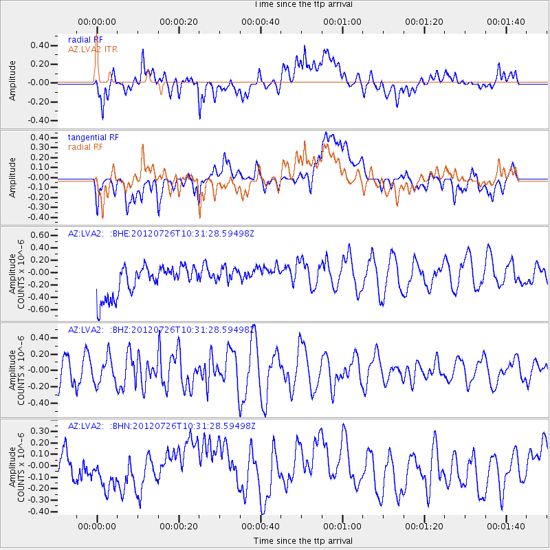
LVA2 AZ.LVA2 - Earthquake Result Viewer
*The percent match for this event was below the threshold and hence no stack was calculated.
| Earthquake location: |
Tonga Islands |
| Earthquake latitude/longitude: |
-21.0/-174.5 |
| Earthquake time(UTC): |
2012/07/26 (208) 10:20:05 GMT |
| Earthquake Depth: |
10 km |
| Earthquake Magnitude: |
5.5 MW, 5.3 MS, 5.4 MB, 5.6 MW |
| Earthquake Catalog/Contributor: |
WHDF/NEIC |
|
| Network: |
AZ ANZA Regional Network |
| Station: |
LVA2 AZ.LVA2 |
| Lat/Lon: |
33.35 N/116.56 W |
| Elevation: |
1435 m |
|
| Distance: |
77.3 deg |
| Az: |
46.644 deg |
| Baz: |
234.255 deg |
| Ray Param: |
$rayparam |
*The percent match for this event was below the threshold and hence was not used in the summary stack. |
|
| Radial Match: |
57.021656 % |
| Radial Bump: |
400 |
| Transverse Match: |
46.043716 % |
| Transverse Bump: |
400 |
| SOD ConfigId: |
469095 |
| Insert Time: |
2013-02-22 00:51:40.363 +0000 |
| GWidth: |
2.5 |
| Max Bumps: |
400 |
| Tol: |
0.001 |
|
Signal To Noise
| Channel | StoN | STA | LTA |
| AZ:LVA2: :BHZ:20120726T10:31:28.59498Z | 1.1861687 | 1.6419462E-7 | 1.3842434E-7 |
| AZ:LVA2: :BHN:20120726T10:31:28.59498Z | 1.3048365 | 1.9872046E-7 | 1.5229529E-7 |
| AZ:LVA2: :BHE:20120726T10:31:28.59498Z | 0.63193715 | 1.4861808E-7 | 2.3517858E-7 |
| Arrivals |
| Ps | |
| PpPs | |
| PsPs/PpSs | |


