You are here: Home > Network List > TA - USArray Transportable Network (new EarthScope stations) Stations List
> Station L37A Phoenix Point, Boone, IA, USA > Earthquake Result Viewer
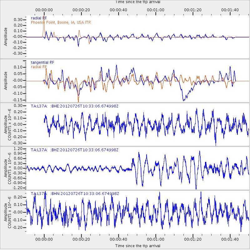
L37A Phoenix Point, Boone, IA, USA - Earthquake Result Viewer
*The percent match for this event was below the threshold and hence no stack was calculated.
| Earthquake location: |
Tonga Islands |
| Earthquake latitude/longitude: |
-21.0/-174.5 |
| Earthquake time(UTC): |
2012/07/26 (208) 10:20:05 GMT |
| Earthquake Depth: |
10 km |
| Earthquake Magnitude: |
5.5 MW, 5.3 MS, 5.4 MB, 5.6 MW |
| Earthquake Catalog/Contributor: |
WHDF/NEIC |
|
| Network: |
TA USArray Transportable Network (new EarthScope stations) |
| Station: |
L37A Phoenix Point, Boone, IA, USA |
| Lat/Lon: |
42.12 N/93.75 W |
| Elevation: |
312 m |
|
| Distance: |
97.3 deg |
| Az: |
47.745 deg |
| Baz: |
248.366 deg |
| Ray Param: |
$rayparam |
*The percent match for this event was below the threshold and hence was not used in the summary stack. |
|
| Radial Match: |
57.765327 % |
| Radial Bump: |
400 |
| Transverse Match: |
43.857723 % |
| Transverse Bump: |
400 |
| SOD ConfigId: |
469095 |
| Insert Time: |
2013-02-22 00:54:19.037 +0000 |
| GWidth: |
2.5 |
| Max Bumps: |
400 |
| Tol: |
0.001 |
|
Signal To Noise
| Channel | StoN | STA | LTA |
| TA:L37A: :BHZ:20120726T10:33:06.674998Z | 1.897478 | 1.4035736E-7 | 7.3970476E-8 |
| TA:L37A: :BHN:20120726T10:33:06.674998Z | 1.2547727 | 1.1884364E-7 | 9.471328E-8 |
| TA:L37A: :BHE:20120726T10:33:06.674998Z | 0.9051897 | 8.1827416E-8 | 9.039809E-8 |
| Arrivals |
| Ps | |
| PpPs | |
| PsPs/PpSs | |


