You are here: Home > Network List > TA - USArray Transportable Network (new EarthScope stations) Stations List
> Station W45A Hickory Valley, TN, USA > Earthquake Result Viewer
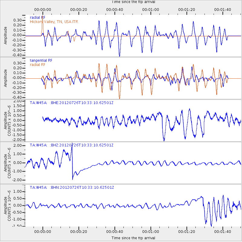
W45A Hickory Valley, TN, USA - Earthquake Result Viewer
*The percent match for this event was below the threshold and hence no stack was calculated.
| Earthquake location: |
Tonga Islands |
| Earthquake latitude/longitude: |
-21.0/-174.5 |
| Earthquake time(UTC): |
2012/07/26 (208) 10:20:05 GMT |
| Earthquake Depth: |
10 km |
| Earthquake Magnitude: |
5.5 MW, 5.3 MS, 5.4 MB, 5.6 MW |
| Earthquake Catalog/Contributor: |
WHDF/NEIC |
|
| Network: |
TA USArray Transportable Network (new EarthScope stations) |
| Station: |
W45A Hickory Valley, TN, USA |
| Lat/Lon: |
35.16 N/89.19 W |
| Elevation: |
187 m |
|
| Distance: |
98.1 deg |
| Az: |
55.585 deg |
| Baz: |
250.16 deg |
| Ray Param: |
$rayparam |
*The percent match for this event was below the threshold and hence was not used in the summary stack. |
|
| Radial Match: |
65.66845 % |
| Radial Bump: |
400 |
| Transverse Match: |
58.613228 % |
| Transverse Bump: |
400 |
| SOD ConfigId: |
469095 |
| Insert Time: |
2013-02-22 00:55:08.404 +0000 |
| GWidth: |
2.5 |
| Max Bumps: |
400 |
| Tol: |
0.001 |
|
Signal To Noise
| Channel | StoN | STA | LTA |
| TA:W45A: :BHZ:20120726T10:33:10.62501Z | 0.48153013 | 5.1925963E-7 | 1.0783533E-6 |
| TA:W45A: :BHN:20120726T10:33:10.62501Z | 0.76192504 | 8.115828E-8 | 1.06517405E-7 |
| TA:W45A: :BHE:20120726T10:33:10.62501Z | 1.7487714 | 3.8024007E-7 | 2.1743269E-7 |
| Arrivals |
| Ps | |
| PpPs | |
| PsPs/PpSs | |


