You are here: Home > Network List > CI - Caltech Regional Seismic Network Stations List
> Station TIN Tinemaha, Big Pine, CA, USA > Earthquake Result Viewer
TIN Tinemaha, Big Pine, CA, USA - Earthquake Result Viewer
*The percent match for this event was below the threshold and hence no stack was calculated.
| Earthquake location: |
Southeast Of Loyalty Islands |
| Earthquake latitude/longitude: |
-21.1/169.5 |
| Earthquake time(UTC): |
2012/07/26 (208) 10:48:22 GMT |
| Earthquake Depth: |
33 km |
| Earthquake Magnitude: |
5.6 MW, 5.4 MS, 5.2 MB |
| Earthquake Catalog/Contributor: |
WHDF/NEIC |
|
| Network: |
CI Caltech Regional Seismic Network |
| Station: |
TIN Tinemaha, Big Pine, CA, USA |
| Lat/Lon: |
37.05 N/118.23 W |
| Elevation: |
1197 m |
|
| Distance: |
89.3 deg |
| Az: |
49.644 deg |
| Baz: |
242.8 deg |
| Ray Param: |
$rayparam |
*The percent match for this event was below the threshold and hence was not used in the summary stack. |
|
| Radial Match: |
91.9872 % |
| Radial Bump: |
400 |
| Transverse Match: |
55.02007 % |
| Transverse Bump: |
400 |
| SOD ConfigId: |
469095 |
| Insert Time: |
2013-02-22 00:58:37.184 +0000 |
| GWidth: |
2.5 |
| Max Bumps: |
400 |
| Tol: |
0.001 |
|
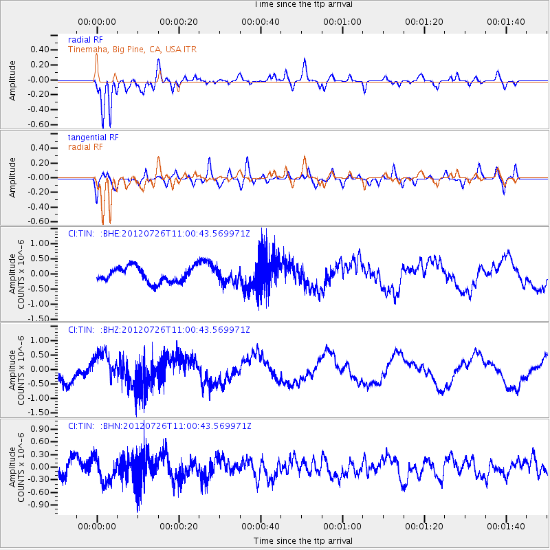
Signal To Noise
| Channel | StoN | STA | LTA |
| CI:TIN: :BHZ:20120726T11:00:43.569971Z | 1.7285094 | 5.435084E-7 | 3.144376E-7 |
| CI:TIN: :BHN:20120726T11:00:43.569971Z | 1.6477927 | 2.8777498E-7 | 1.7464271E-7 |
| CI:TIN: :BHE:20120726T11:00:43.569971Z | 0.96060705 | 2.4022398E-7 | 2.500752E-7 |
| Arrivals |
| Ps | |
| PpPs | |
| PsPs/PpSs | |


