You are here: Home > Network List > TA - USArray Transportable Network (new EarthScope stations) Stations List
> Station R11A Troy Canyon, Currant, NV, USA > Earthquake Result Viewer
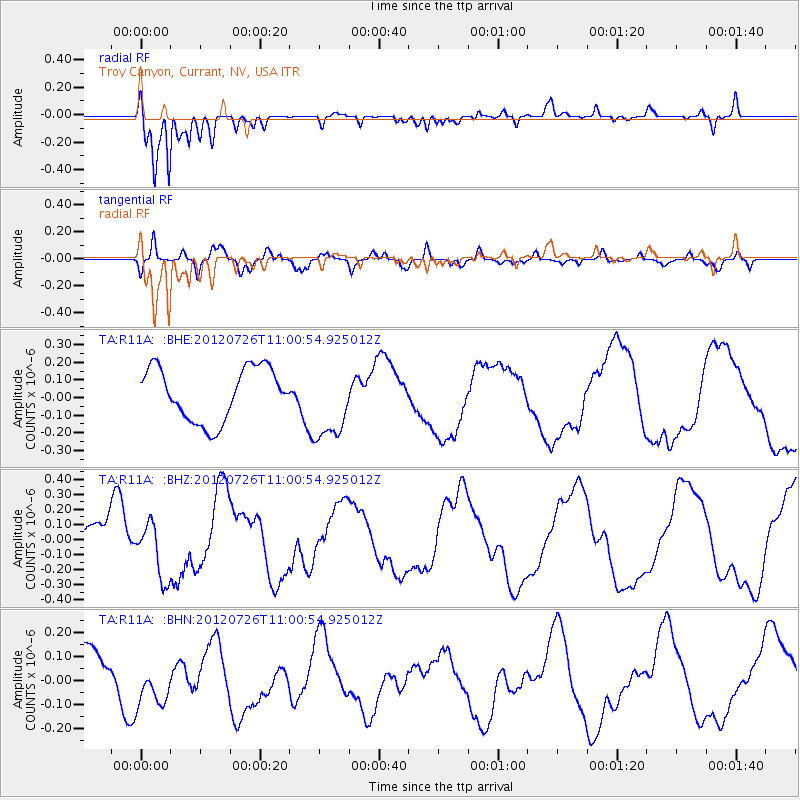
R11A Troy Canyon, Currant, NV, USA - Earthquake Result Viewer
*The percent match for this event was below the threshold and hence no stack was calculated.
| Earthquake location: |
Southeast Of Loyalty Islands |
| Earthquake latitude/longitude: |
-21.1/169.5 |
| Earthquake time(UTC): |
2012/07/26 (208) 10:48:22 GMT |
| Earthquake Depth: |
33 km |
| Earthquake Magnitude: |
5.6 MW, 5.4 MS, 5.2 MB |
| Earthquake Catalog/Contributor: |
WHDF/NEIC |
|
| Network: |
TA USArray Transportable Network (new EarthScope stations) |
| Station: |
R11A Troy Canyon, Currant, NV, USA |
| Lat/Lon: |
38.35 N/115.59 W |
| Elevation: |
1756 m |
|
| Distance: |
91.7 deg |
| Az: |
49.419 deg |
| Baz: |
244.413 deg |
| Ray Param: |
$rayparam |
*The percent match for this event was below the threshold and hence was not used in the summary stack. |
|
| Radial Match: |
91.87204 % |
| Radial Bump: |
327 |
| Transverse Match: |
52.197678 % |
| Transverse Bump: |
400 |
| SOD ConfigId: |
469095 |
| Insert Time: |
2013-02-22 01:00:12.101 +0000 |
| GWidth: |
2.5 |
| Max Bumps: |
400 |
| Tol: |
0.001 |
|
Signal To Noise
| Channel | StoN | STA | LTA |
| TA:R11A: :BHZ:20120726T11:00:54.925012Z | 1.1608036 | 1.9124639E-7 | 1.6475344E-7 |
| TA:R11A: :BHN:20120726T11:00:54.925012Z | 0.83385706 | 8.9553936E-8 | 1.07397234E-7 |
| TA:R11A: :BHE:20120726T11:00:54.925012Z | 1.4529781 | 2.1812092E-7 | 1.5011989E-7 |
| Arrivals |
| Ps | |
| PpPs | |
| PsPs/PpSs | |


