COLD Coldfoot Broadband - Earthquake Result Viewer
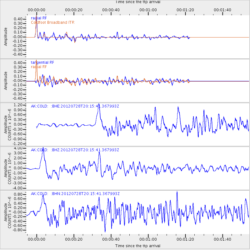
Earthquake location: New Ireland Region, P.N.G.
Earthquake latitude/longitude: -4.7/153.2
Earthquake time(UTC): 2012/07/28 (210) 20:03:56 GMT
Earthquake Depth: 41 km
Earthquake Magnitude: 6.1 MB, 6.3 MS, 6.5 MW, 6.5 MW
Earthquake Catalog/Contributor: WHDF/NEIC
Network: AK Alaska Regional Network
Station: COLD Coldfoot Broadband
Lat/Lon: 67.23 N/150.20 W
Elevation: 377 m
Distance: 82.0 deg
Az: 19.165 deg
Baz: 237.201 deg
Ray Param: 0.047130723
Estimated Moho Depth: 42.5 km
Estimated Crust Vp/Vs: 1.65
Assumed Crust Vp: 6.577 km/s
Estimated Crust Vs: 3.986 km/s
Estimated Crust Poisson's Ratio: 0.21
Radial Match: 94.52529 %
Radial Bump: 381
Transverse Match: 83.13943 %
Transverse Bump: 400
SOD ConfigId: 469095
Insert Time: 2013-02-22 01:02:05.514 +0000
GWidth: 2.5
Max Bumps: 400
Tol: 0.001

Signal To Noise

ChannelStoNSTALTA
AK:COLD: :BHZ:20120728T20:15:41.367993Z22.959821.8761142E-68.1712926E-8
AK:COLD: :BHN:20120728T20:15:41.367993Z5.02177953.7951884E-77.557457E-8
AK:COLD: :BHE:20120728T20:15:41.367993Z9.9767925.8272195E-75.8407746E-8
Arrivals
Ps4.3 SECOND
PpPs17 SECOND
PsPs/PpSs21 SECOND