You are here: Home > Network List > CI - Caltech Regional Seismic Network Stations List
> Station MPP McPhearson Peak > Earthquake Result Viewer
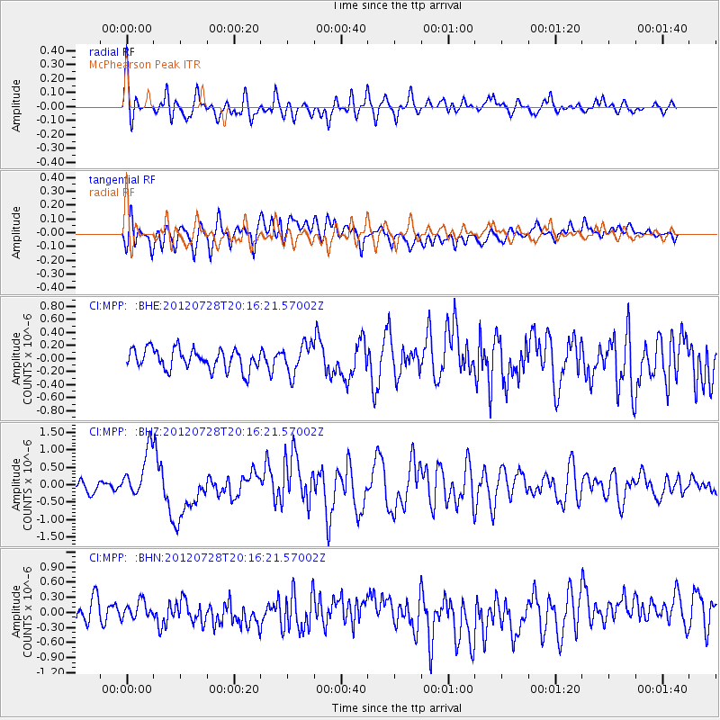
MPP McPhearson Peak - Earthquake Result Viewer
*The percent match for this event was below the threshold and hence no stack was calculated.
| Earthquake location: |
New Ireland Region, P.N.G. |
| Earthquake latitude/longitude: |
-4.7/153.2 |
| Earthquake time(UTC): |
2012/07/28 (210) 20:03:56 GMT |
| Earthquake Depth: |
41 km |
| Earthquake Magnitude: |
6.1 MB, 6.3 MS, 6.5 MW, 6.5 MW |
| Earthquake Catalog/Contributor: |
WHDF/NEIC |
|
| Network: |
CI Caltech Regional Seismic Network |
| Station: |
MPP McPhearson Peak |
| Lat/Lon: |
34.89 N/119.81 W |
| Elevation: |
1739 m |
|
| Distance: |
90.2 deg |
| Az: |
55.18 deg |
| Baz: |
264.503 deg |
| Ray Param: |
$rayparam |
*The percent match for this event was below the threshold and hence was not used in the summary stack. |
|
| Radial Match: |
69.05166 % |
| Radial Bump: |
400 |
| Transverse Match: |
74.92347 % |
| Transverse Bump: |
400 |
| SOD ConfigId: |
469095 |
| Insert Time: |
2013-02-22 01:09:37.264 +0000 |
| GWidth: |
2.5 |
| Max Bumps: |
400 |
| Tol: |
0.001 |
|
Signal To Noise
| Channel | StoN | STA | LTA |
| CI:MPP: :BHZ:20120728T20:16:21.57002Z | 5.1912503 | 6.8488157E-7 | 1.3192998E-7 |
| CI:MPP: :BHN:20120728T20:16:21.57002Z | 0.9044865 | 1.6904838E-7 | 1.8689984E-7 |
| CI:MPP: :BHE:20120728T20:16:21.57002Z | 1.4401824 | 2.2689709E-7 | 1.5754746E-7 |
| Arrivals |
| Ps | |
| PpPs | |
| PsPs/PpSs | |


