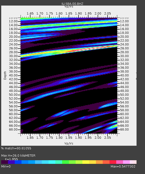
SBA Scott Base, Antarctica - Earthquake Result Viewer
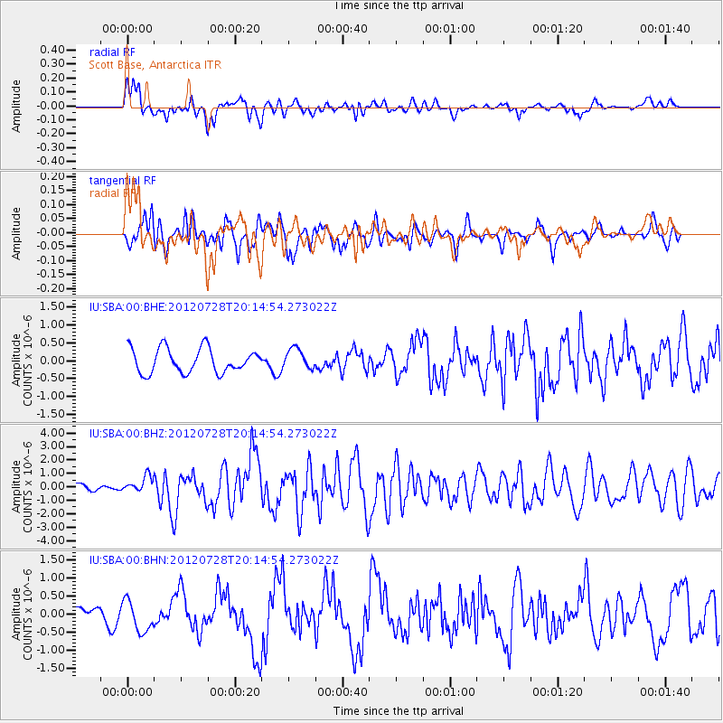
Earthquake location: New Ireland Region, P.N.G.
Earthquake latitude/longitude: -4.7/153.2
Earthquake time(UTC): 2012/07/28 (210) 20:03:56 GMT
Earthquake Depth: 41 km
Earthquake Magnitude: 6.1 MB, 6.3 MS, 6.5 MW, 6.5 MW
Earthquake Catalog/Contributor: WHDF/NEIC
Network: IU Global Seismograph Network (GSN - IRIS/USGS)
Station: SBA Scott Base, Antarctica
Lat/Lon: 77.85 S/166.76 E
Elevation: 50 m
Distance: 73.5 deg
Az: 177.025 deg
Baz: 345.868 deg
Ray Param: 0.052891016
Estimated Moho Depth: 26.0 km
Estimated Crust Vp/Vs: 1.96
Assumed Crust Vp: 6.183 km/s
Estimated Crust Vs: 3.162 km/s
Estimated Crust Poisson's Ratio: 0.32
Radial Match: 80.81055 %
Radial Bump: 400
Transverse Match: 63.563145 %
Transverse Bump: 400
SOD ConfigId: 469095
Insert Time: 2013-02-22 01:11:57.835 +0000
GWidth: 2.5
Max Bumps: 400
Tol: 0.001

Signal To Noise

ChannelStoNSTALTA
IU:SBA:00:BHZ:20120728T20:14:54.273022Z2.11961486.14055E-72.897012E-7
IU:SBA:00:BHN:20120728T20:14:54.273022Z1.87768354.279243E-72.2790013E-7
IU:SBA:00:BHE:20120728T20:14:54.273022Z0.819228772.783559E-73.39778E-7
Arrivals
Ps4.1 SECOND
PpPs12 SECOND
PsPs/PpSs16 SECOND