N02D Trinity Center, CA, USA - Earthquake Result Viewer
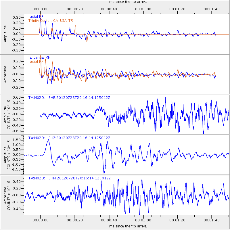
Earthquake location: New Ireland Region, P.N.G.
Earthquake latitude/longitude: -4.7/153.2
Earthquake time(UTC): 2012/07/28 (210) 20:03:56 GMT
Earthquake Depth: 41 km
Earthquake Magnitude: 6.1 MB, 6.3 MS, 6.5 MW, 6.5 MW
Earthquake Catalog/Contributor: WHDF/NEIC
Network: TA USArray Transportable Network (new EarthScope stations)
Station: N02D Trinity Center, CA, USA
Lat/Lon: 40.97 N/122.71 W
Elevation: 937 m
Distance: 88.6 deg
Az: 48.888 deg
Baz: 262.663 deg
Ray Param: 0.042415418
Estimated Moho Depth: 21.75 km
Estimated Crust Vp/Vs: 1.90
Assumed Crust Vp: 6.566 km/s
Estimated Crust Vs: 3.46 km/s
Estimated Crust Poisson's Ratio: 0.31
Radial Match: 89.172005 %
Radial Bump: 400
Transverse Match: 82.85083 %
Transverse Bump: 400
SOD ConfigId: 469095
Insert Time: 2013-02-22 01:15:18.876 +0000
GWidth: 2.5
Max Bumps: 400
Tol: 0.001

Signal To Noise

ChannelStoNSTALTA
TA:N02D: :BHZ:20120728T20:16:14.125012Z12.1457727.6397373E-76.2900384E-8
TA:N02D: :BHN:20120728T20:16:14.125012Z0.527844373.586807E-86.795198E-8
TA:N02D: :BHE:20120728T20:16:14.125012Z3.17295981.5659411E-74.9352693E-8
Arrivals
Ps3.0 SECOND
PpPs9.4 SECOND
PsPs/PpSs12 SECOND