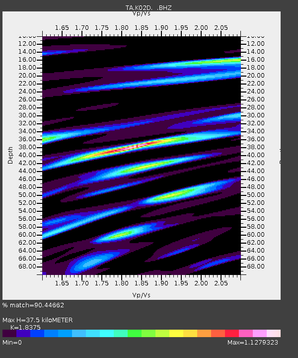
K02D Willamette Meridian, OR, USA - Earthquake Result Viewer
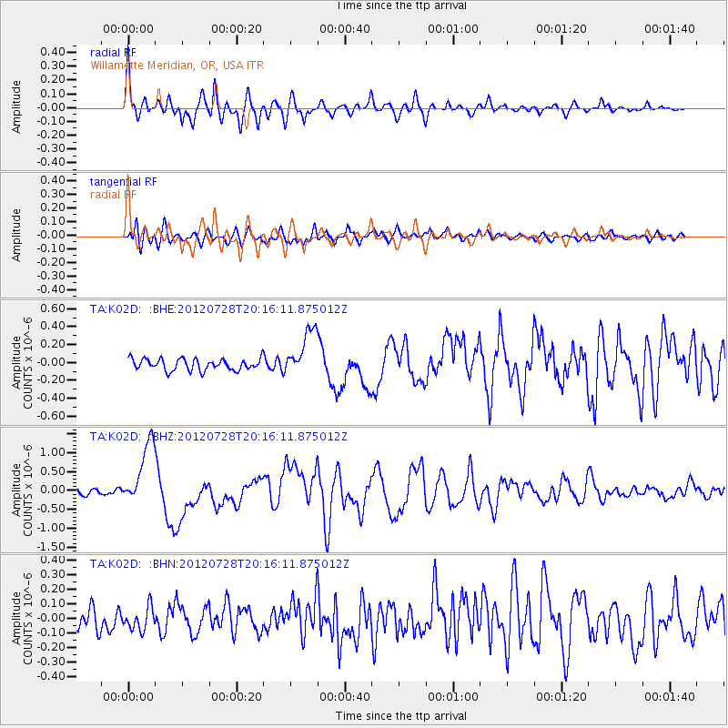
Earthquake location: New Ireland Region, P.N.G.
Earthquake latitude/longitude: -4.7/153.2
Earthquake time(UTC): 2012/07/28 (210) 20:03:56 GMT
Earthquake Depth: 41 km
Earthquake Magnitude: 6.1 MB, 6.3 MS, 6.5 MW, 6.5 MW
Earthquake Catalog/Contributor: WHDF/NEIC
Network: TA USArray Transportable Network (new EarthScope stations)
Station: K02D Willamette Meridian, OR, USA
Lat/Lon: 42.70 N/123.67 W
Elevation: 989 m
Distance: 88.1 deg
Az: 47.087 deg
Baz: 261.973 deg
Ray Param: 0.042773124
Estimated Moho Depth: 37.5 km
Estimated Crust Vp/Vs: 1.84
Assumed Crust Vp: 6.522 km/s
Estimated Crust Vs: 3.549 km/s
Estimated Crust Poisson's Ratio: 0.29
Radial Match: 90.44662 %
Radial Bump: 400
Transverse Match: 73.03622 %
Transverse Bump: 400
SOD ConfigId: 469095
Insert Time: 2013-02-22 01:15:53.812 +0000
GWidth: 2.5
Max Bumps: 400
Tol: 0.001

Signal To Noise

ChannelStoNSTALTA
TA:K02D: :BHZ:20120728T20:16:11.875012Z11.8831828.573159E-77.214532E-8
TA:K02D: :BHN:20120728T20:16:11.875012Z1.1905637.81045E-86.5603E-8
TA:K02D: :BHE:20120728T20:16:11.875012Z4.20279742.641522E-76.285152E-8
Arrivals
Ps4.9 SECOND
PpPs16 SECOND
PsPs/PpSs21 SECOND