LON Longmire (broad-band and DWWSSN) - Earthquake Result Viewer
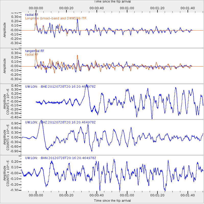
Earthquake location: New Ireland Region, P.N.G.
Earthquake latitude/longitude: -4.7/153.2
Earthquake time(UTC): 2012/07/28 (210) 20:03:56 GMT
Earthquake Depth: 41 km
Earthquake Magnitude: 6.1 MB, 6.3 MS, 6.5 MW, 6.5 MW
Earthquake Catalog/Contributor: WHDF/NEIC
Network: UW Pacific Northwest Regional Seismic Network
Station: LON Longmire (broad-band and DWWSSN)
Lat/Lon: 46.75 N/121.81 W
Elevation: 850 m
Distance: 89.9 deg
Az: 43.237 deg
Baz: 263.209 deg
Ray Param: 0.041703176
Estimated Moho Depth: 22.0 km
Estimated Crust Vp/Vs: 1.87
Assumed Crust Vp: 6.597 km/s
Estimated Crust Vs: 3.528 km/s
Estimated Crust Poisson's Ratio: 0.30
Radial Match: 90.58437 %
Radial Bump: 400
Transverse Match: 73.09158 %
Transverse Bump: 400
SOD ConfigId: 469095
Insert Time: 2013-02-22 01:17:31.895 +0000
GWidth: 2.5
Max Bumps: 400
Tol: 0.001

Signal To Noise

ChannelStoNSTALTA
UW:LON: :BHZ:20120728T20:16:20.464978Z12.8055036.836204E-75.338489E-8
UW:LON: :BHN:20120728T20:16:20.464978Z1.04521365.5654258E-85.3246783E-8
UW:LON: :BHE:20120728T20:16:20.464978Z8.1797972.5719004E-73.1442102E-8
Arrivals
Ps3.0 SECOND
PpPs9.4 SECOND
PsPs/PpSs12 SECOND