You are here: Home > Network List > UW - Pacific Northwest Regional Seismic Network Stations List
> Station MRBL Marblemount, WA, USA > Earthquake Result Viewer
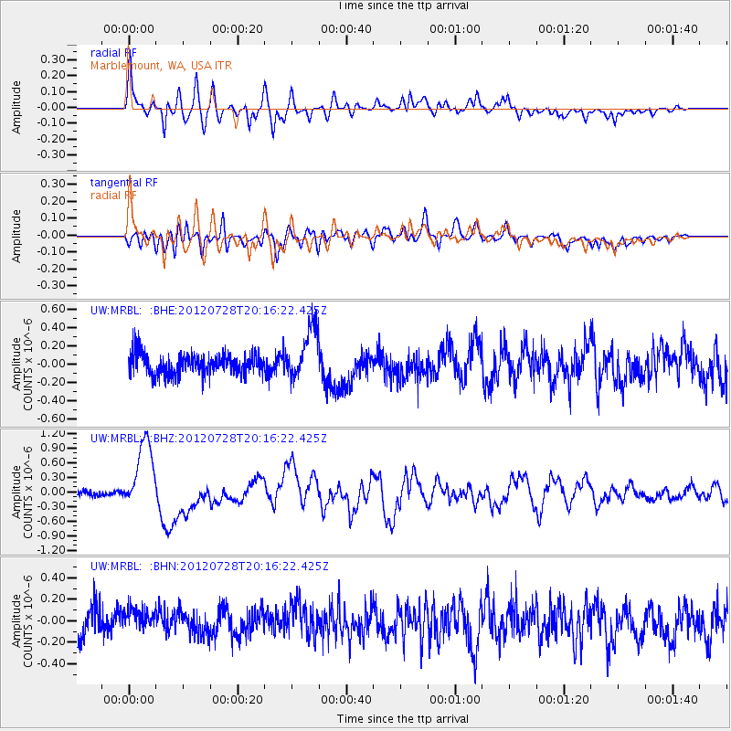
MRBL Marblemount, WA, USA - Earthquake Result Viewer
*The percent match for this event was below the threshold and hence no stack was calculated.
| Earthquake location: |
New Ireland Region, P.N.G. |
| Earthquake latitude/longitude: |
-4.7/153.2 |
| Earthquake time(UTC): |
2012/07/28 (210) 20:03:56 GMT |
| Earthquake Depth: |
41 km |
| Earthquake Magnitude: |
6.1 MB, 6.3 MS, 6.5 MW, 6.5 MW |
| Earthquake Catalog/Contributor: |
WHDF/NEIC |
|
| Network: |
UW Pacific Northwest Regional Seismic Network |
| Station: |
MRBL Marblemount, WA, USA |
| Lat/Lon: |
48.52 N/121.48 W |
| Elevation: |
75 m |
|
| Distance: |
90.4 deg |
| Az: |
41.506 deg |
| Baz: |
263.453 deg |
| Ray Param: |
$rayparam |
*The percent match for this event was below the threshold and hence was not used in the summary stack. |
|
| Radial Match: |
79.16286 % |
| Radial Bump: |
400 |
| Transverse Match: |
58.363647 % |
| Transverse Bump: |
400 |
| SOD ConfigId: |
469095 |
| Insert Time: |
2013-02-22 01:18:19.873 +0000 |
| GWidth: |
2.5 |
| Max Bumps: |
400 |
| Tol: |
0.001 |
|
Signal To Noise
| Channel | StoN | STA | LTA |
| UW:MRBL: :BHZ:20120728T20:16:22.425Z | 11.3673115 | 7.315146E-7 | 6.435248E-8 |
| UW:MRBL: :BHN:20120728T20:16:22.425Z | 0.8461423 | 1.1567505E-7 | 1.3670875E-7 |
| UW:MRBL: :BHE:20120728T20:16:22.425Z | 2.538042 | 2.798433E-7 | 1.1025952E-7 |
| Arrivals |
| Ps | |
| PpPs | |
| PsPs/PpSs | |


