LEBA Lebam, WA, USA - Earthquake Result Viewer
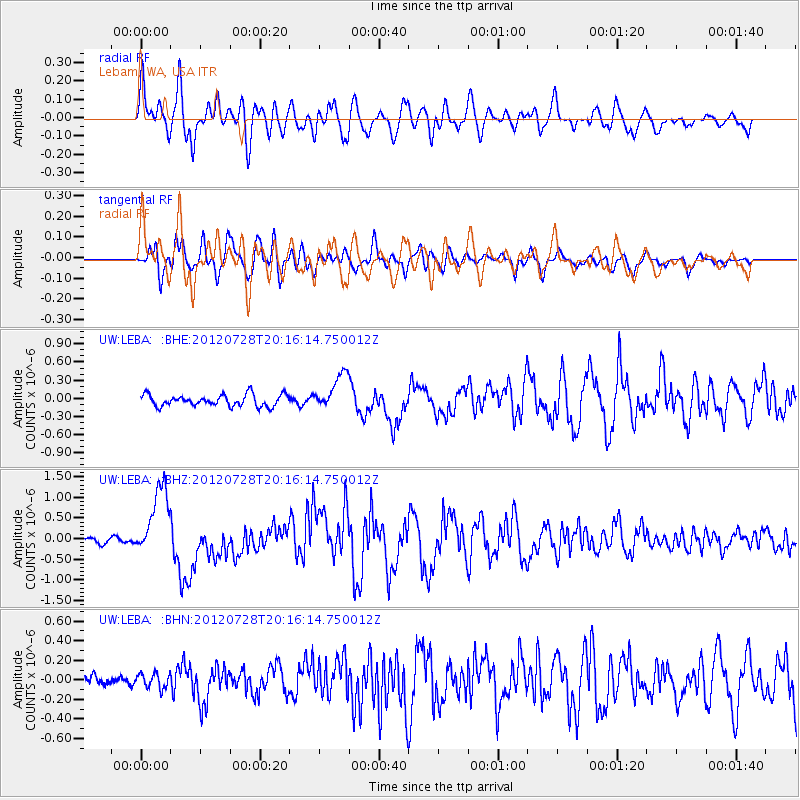
Earthquake location: New Ireland Region, P.N.G.
Earthquake latitude/longitude: -4.7/153.2
Earthquake time(UTC): 2012/07/28 (210) 20:03:56 GMT
Earthquake Depth: 41 km
Earthquake Magnitude: 6.1 MB, 6.3 MS, 6.5 MW, 6.5 MW
Earthquake Catalog/Contributor: WHDF/NEIC
Network: UW Pacific Northwest Regional Seismic Network
Station: LEBA Lebam, WA, USA
Lat/Lon: 46.55 N/123.56 W
Elevation: 73 m
Distance: 88.7 deg
Az: 43.284 deg
Baz: 261.939 deg
Ray Param: 0.04231845
Estimated Moho Depth: 54.75 km
Estimated Crust Vp/Vs: 1.77
Assumed Crust Vp: 6.566 km/s
Estimated Crust Vs: 3.704 km/s
Estimated Crust Poisson's Ratio: 0.27
Radial Match: 85.27009 %
Radial Bump: 400
Transverse Match: 84.32271 %
Transverse Bump: 400
SOD ConfigId: 469095
Insert Time: 2013-02-22 01:18:43.318 +0000
GWidth: 2.5
Max Bumps: 400
Tol: 0.001

Signal To Noise

ChannelStoNSTALTA
UW:LEBA: :BHZ:20120728T20:16:14.750012Z14.6641248.56732E-75.8423677E-8
UW:LEBA: :BHN:20120728T20:16:14.750012Z0.91032797.562203E-88.30712E-8
UW:LEBA: :BHE:20120728T20:16:14.750012Z3.07088182.9394965E-79.572158E-8
Arrivals
Ps6.6 SECOND
PpPs23 SECOND
PsPs/PpSs29 SECOND