You are here: Home > Network List > G - GEOSCOPE Stations List
> Station TAM Tamanrasset, Algeria > Earthquake Result Viewer
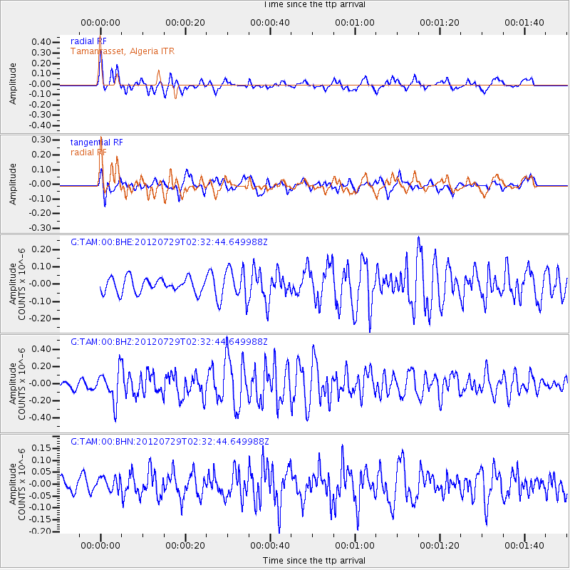
TAM Tamanrasset, Algeria - Earthquake Result Viewer
*The percent match for this event was below the threshold and hence no stack was calculated.
| Earthquake location: |
Myanmar |
| Earthquake latitude/longitude: |
22.9/94.3 |
| Earthquake time(UTC): |
2012/07/29 (211) 02:21:12 GMT |
| Earthquake Depth: |
75 km |
| Earthquake Magnitude: |
5.8 MB, 5.7 MW, 5.8 MW |
| Earthquake Catalog/Contributor: |
WHDF/NEIC |
|
| Network: |
G GEOSCOPE |
| Station: |
TAM Tamanrasset, Algeria |
| Lat/Lon: |
22.79 N/5.53 E |
| Elevation: |
1377 m |
|
| Distance: |
80.4 deg |
| Az: |
290.633 deg |
| Baz: |
69.208 deg |
| Ray Param: |
$rayparam |
*The percent match for this event was below the threshold and hence was not used in the summary stack. |
|
| Radial Match: |
64.16472 % |
| Radial Bump: |
400 |
| Transverse Match: |
55.177437 % |
| Transverse Bump: |
400 |
| SOD ConfigId: |
469095 |
| Insert Time: |
2013-02-22 01:24:03.739 +0000 |
| GWidth: |
2.5 |
| Max Bumps: |
400 |
| Tol: |
0.001 |
|
Signal To Noise
| Channel | StoN | STA | LTA |
| G:TAM:00:BHZ:20120729T02:32:44.649988Z | 3.0725818 | 1.8318643E-7 | 5.961971E-8 |
| G:TAM:00:BHN:20120729T02:32:44.649988Z | 0.6385129 | 2.9520951E-8 | 4.6233918E-8 |
| G:TAM:00:BHE:20120729T02:32:44.649988Z | 2.070258 | 8.577456E-8 | 4.1431818E-8 |
| Arrivals |
| Ps | |
| PpPs | |
| PsPs/PpSs | |


