You are here: Home > Network List > IU - Global Seismograph Network (GSN - IRIS/USGS) Stations List
> Station GRFO Grafenberg, Germany > Earthquake Result Viewer
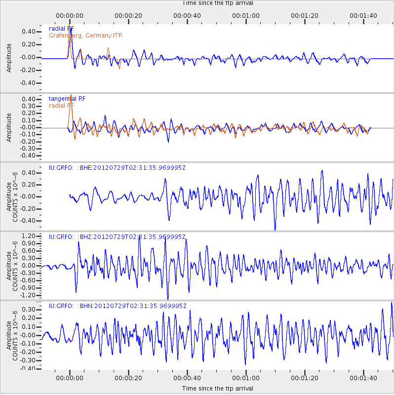
GRFO Grafenberg, Germany - Earthquake Result Viewer
*The percent match for this event was below the threshold and hence no stack was calculated.
| Earthquake location: |
Myanmar |
| Earthquake latitude/longitude: |
22.9/94.3 |
| Earthquake time(UTC): |
2012/07/29 (211) 02:21:12 GMT |
| Earthquake Depth: |
75 km |
| Earthquake Magnitude: |
5.8 MB, 5.7 MW, 5.8 MW |
| Earthquake Catalog/Contributor: |
WHDF/NEIC |
|
| Network: |
IU Global Seismograph Network (GSN - IRIS/USGS) |
| Station: |
GRFO Grafenberg, Germany |
| Lat/Lon: |
49.69 N/11.22 E |
| Elevation: |
384 m |
|
| Distance: |
68.5 deg |
| Az: |
316.132 deg |
| Baz: |
79.649 deg |
| Ray Param: |
$rayparam |
*The percent match for this event was below the threshold and hence was not used in the summary stack. |
|
| Radial Match: |
79.579254 % |
| Radial Bump: |
400 |
| Transverse Match: |
79.2167 % |
| Transverse Bump: |
400 |
| SOD ConfigId: |
469095 |
| Insert Time: |
2013-02-22 01:24:48.676 +0000 |
| GWidth: |
2.5 |
| Max Bumps: |
400 |
| Tol: |
0.001 |
|
Signal To Noise
| Channel | StoN | STA | LTA |
| IU:GRFO: :BHZ:20120729T02:31:35.969995Z | 6.1836634 | 4.1464733E-7 | 6.705529E-8 |
| IU:GRFO: :BHN:20120729T02:31:35.969995Z | 1.7641997 | 9.693387E-8 | 5.494495E-8 |
| IU:GRFO: :BHE:20120729T02:31:35.969995Z | 2.5210717 | 1.6919512E-7 | 6.711238E-8 |
| Arrivals |
| Ps | |
| PpPs | |
| PsPs/PpSs | |


