You are here: Home > Network List > IW - Intermountain West Stations List
> Station MOOW Moose Ponds, Wyoming, USA > Earthquake Result Viewer
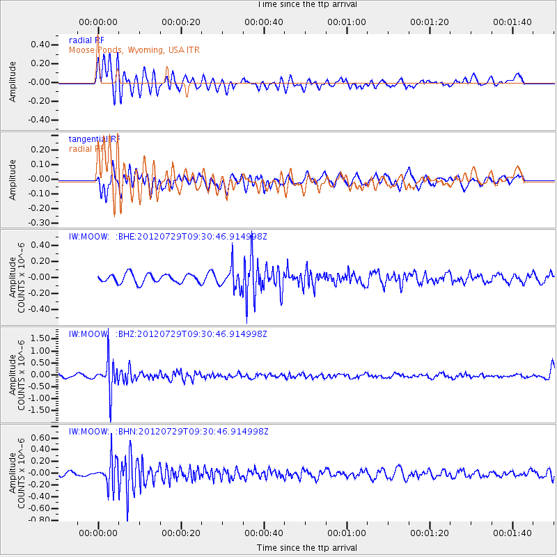
MOOW Moose Ponds, Wyoming, USA - Earthquake Result Viewer
*The percent match for this event was below the threshold and hence no stack was calculated.
| Earthquake location: |
Primor'ye, Russia |
| Earthquake latitude/longitude: |
47.4/139.1 |
| Earthquake time(UTC): |
2012/07/29 (211) 09:20:54 GMT |
| Earthquake Depth: |
502 km |
| Earthquake Magnitude: |
5.6 MB, 5.6 MW, 5.7 MW |
| Earthquake Catalog/Contributor: |
WHDF/NEIC |
|
| Network: |
IW Intermountain West |
| Station: |
MOOW Moose Ponds, Wyoming, USA |
| Lat/Lon: |
43.75 N/110.74 W |
| Elevation: |
2128 m |
|
| Distance: |
70.4 deg |
| Az: |
46.226 deg |
| Baz: |
317.379 deg |
| Ray Param: |
$rayparam |
*The percent match for this event was below the threshold and hence was not used in the summary stack. |
|
| Radial Match: |
70.58235 % |
| Radial Bump: |
400 |
| Transverse Match: |
58.044468 % |
| Transverse Bump: |
400 |
| SOD ConfigId: |
469095 |
| Insert Time: |
2013-02-22 01:39:08.343 +0000 |
| GWidth: |
2.5 |
| Max Bumps: |
400 |
| Tol: |
0.001 |
|
Signal To Noise
| Channel | StoN | STA | LTA |
| IW:MOOW: :BHZ:20120729T09:30:46.914998Z | 9.237736 | 6.496837E-7 | 7.032932E-8 |
| IW:MOOW: :BHN:20120729T09:30:46.914998Z | 6.057311 | 2.2403908E-7 | 3.6986556E-8 |
| IW:MOOW: :BHE:20120729T09:30:46.914998Z | 2.4445138 | 1.3199431E-7 | 5.3996143E-8 |
| Arrivals |
| Ps | |
| PpPs | |
| PsPs/PpSs | |


