You are here: Home > Network List > TA - USArray Transportable Network (new EarthScope stations) Stations List
> Station E38A The Farm, Brule, WI, USA > Earthquake Result Viewer
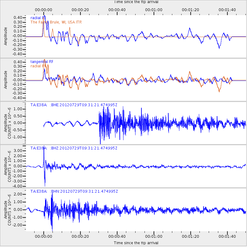
E38A The Farm, Brule, WI, USA - Earthquake Result Viewer
*The percent match for this event was below the threshold and hence no stack was calculated.
| Earthquake location: |
Primor'ye, Russia |
| Earthquake latitude/longitude: |
47.4/139.1 |
| Earthquake time(UTC): |
2012/07/29 (211) 09:20:54 GMT |
| Earthquake Depth: |
502 km |
| Earthquake Magnitude: |
5.6 MB, 5.6 MW, 5.7 MW |
| Earthquake Catalog/Contributor: |
WHDF/NEIC |
|
| Network: |
TA USArray Transportable Network (new EarthScope stations) |
| Station: |
E38A The Farm, Brule, WI, USA |
| Lat/Lon: |
46.61 N/91.55 W |
| Elevation: |
341 m |
|
| Distance: |
76.5 deg |
| Az: |
33.244 deg |
| Baz: |
327.291 deg |
| Ray Param: |
$rayparam |
*The percent match for this event was below the threshold and hence was not used in the summary stack. |
|
| Radial Match: |
78.65676 % |
| Radial Bump: |
400 |
| Transverse Match: |
52.427322 % |
| Transverse Bump: |
400 |
| SOD ConfigId: |
469095 |
| Insert Time: |
2013-02-22 02:07:09.937 +0000 |
| GWidth: |
2.5 |
| Max Bumps: |
400 |
| Tol: |
0.001 |
|
Signal To Noise
| Channel | StoN | STA | LTA |
| TA:E38A: :BHZ:20120729T09:31:21.474995Z | 4.867991 | 1.0822163E-6 | 2.2231269E-7 |
| TA:E38A: :BHN:20120729T09:31:21.474995Z | 3.9816608 | 8.2213285E-7 | 2.0647988E-7 |
| TA:E38A: :BHE:20120729T09:31:21.474995Z | 5.715917 | 5.8312963E-7 | 1.0201856E-7 |
| Arrivals |
| Ps | |
| PpPs | |
| PsPs/PpSs | |


