You are here: Home > Network List > UW - Pacific Northwest Regional Seismic Network Stations List
> Station UMAT Pilot Rock, OR, USA > Earthquake Result Viewer
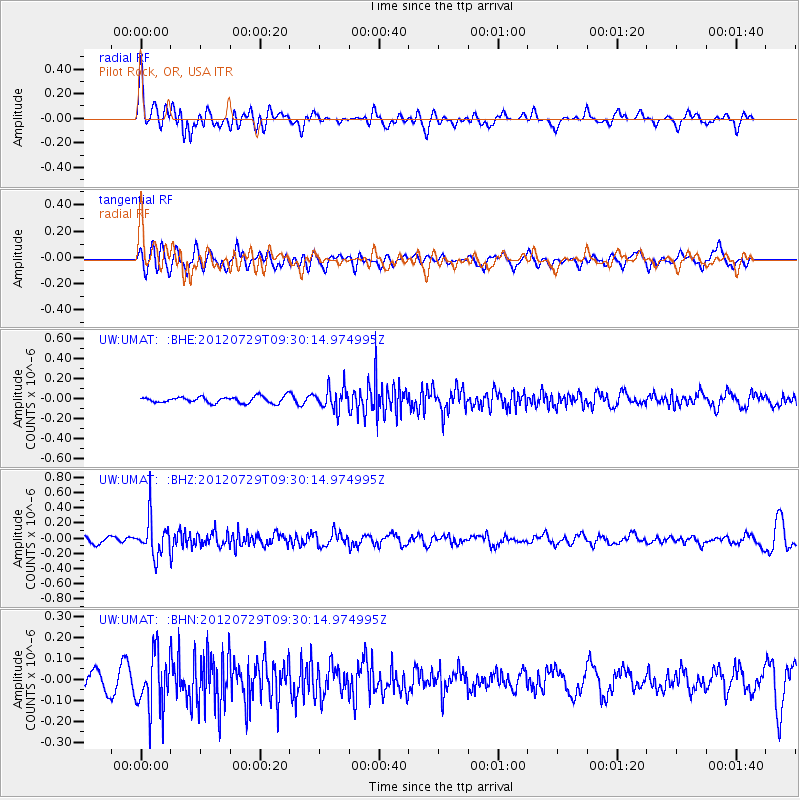
UMAT Pilot Rock, OR, USA - Earthquake Result Viewer
*The percent match for this event was below the threshold and hence no stack was calculated.
| Earthquake location: |
Primor'ye, Russia |
| Earthquake latitude/longitude: |
47.4/139.1 |
| Earthquake time(UTC): |
2012/07/29 (211) 09:20:54 GMT |
| Earthquake Depth: |
502 km |
| Earthquake Magnitude: |
5.6 MB, 5.6 MW, 5.7 MW |
| Earthquake Catalog/Contributor: |
WHDF/NEIC |
|
| Network: |
UW Pacific Northwest Regional Seismic Network |
| Station: |
UMAT Pilot Rock, OR, USA |
| Lat/Lon: |
45.29 N/118.96 W |
| Elevation: |
1318 m |
|
| Distance: |
65.2 deg |
| Az: |
49.55 deg |
| Baz: |
312.893 deg |
| Ray Param: |
$rayparam |
*The percent match for this event was below the threshold and hence was not used in the summary stack. |
|
| Radial Match: |
58.61501 % |
| Radial Bump: |
400 |
| Transverse Match: |
60.631626 % |
| Transverse Bump: |
400 |
| SOD ConfigId: |
469095 |
| Insert Time: |
2013-02-22 02:23:07.729 +0000 |
| GWidth: |
2.5 |
| Max Bumps: |
400 |
| Tol: |
0.001 |
|
Signal To Noise
| Channel | StoN | STA | LTA |
| UW:UMAT: :BHZ:20120729T09:30:14.974995Z | 4.109052 | 2.470629E-7 | 6.0126496E-8 |
| UW:UMAT: :BHN:20120729T09:30:14.974995Z | 2.8211741 | 1.3708049E-7 | 4.858987E-8 |
| UW:UMAT: :BHE:20120729T09:30:14.974995Z | 3.4377341 | 1.08786146E-7 | 3.1644724E-8 |
| Arrivals |
| Ps | |
| PpPs | |
| PsPs/PpSs | |


