You are here: Home > Network List > UW - Pacific Northwest Regional Seismic Network Stations List
> Station LEBA Lebam, WA, USA > Earthquake Result Viewer
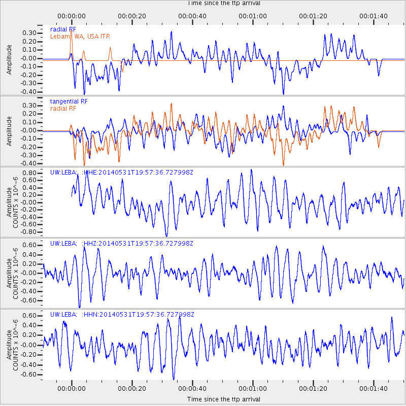
LEBA Lebam, WA, USA - Earthquake Result Viewer
*The percent match for this event was below the threshold and hence no stack was calculated.
| Earthquake location: |
Mindanao, Philippines |
| Earthquake latitude/longitude: |
9.4/126.7 |
| Earthquake time(UTC): |
2014/05/31 (151) 19:44:43 GMT |
| Earthquake Depth: |
48 km |
| Earthquake Magnitude: |
5.1 MW |
| Earthquake Catalog/Contributor: |
ISC/ISC |
|
| Network: |
UW Pacific Northwest Regional Seismic Network |
| Station: |
LEBA Lebam, WA, USA |
| Lat/Lon: |
46.55 N/123.56 W |
| Elevation: |
73 m |
|
| Distance: |
96.5 deg |
| Az: |
40.82 deg |
| Baz: |
290.836 deg |
| Ray Param: |
$rayparam |
*The percent match for this event was below the threshold and hence was not used in the summary stack. |
|
| Radial Match: |
38.52882 % |
| Radial Bump: |
400 |
| Transverse Match: |
49.532455 % |
| Transverse Bump: |
400 |
| SOD ConfigId: |
3390531 |
| Insert Time: |
2019-04-12 03:21:27.337 +0000 |
| GWidth: |
2.5 |
| Max Bumps: |
400 |
| Tol: |
0.001 |
|
Signal To Noise
| Channel | StoN | STA | LTA |
| UW:LEBA: :HHZ:20140531T19:57:36.727998Z | 1.9611266 | 3.8419074E-7 | 1.9590308E-7 |
| UW:LEBA: :HHN:20140531T19:57:36.727998Z | 0.9705453 | 2.3961934E-7 | 2.4689146E-7 |
| UW:LEBA: :HHE:20140531T19:57:36.727998Z | 1.8192493 | 5.5659166E-7 | 3.059458E-7 |
| Arrivals |
| Ps | |
| PpPs | |
| PsPs/PpSs | |


