You are here: Home > Network List > CI - Caltech Regional Seismic Network Stations List
> Station MPM Manuel Prospect Mine, California, USA > Earthquake Result Viewer
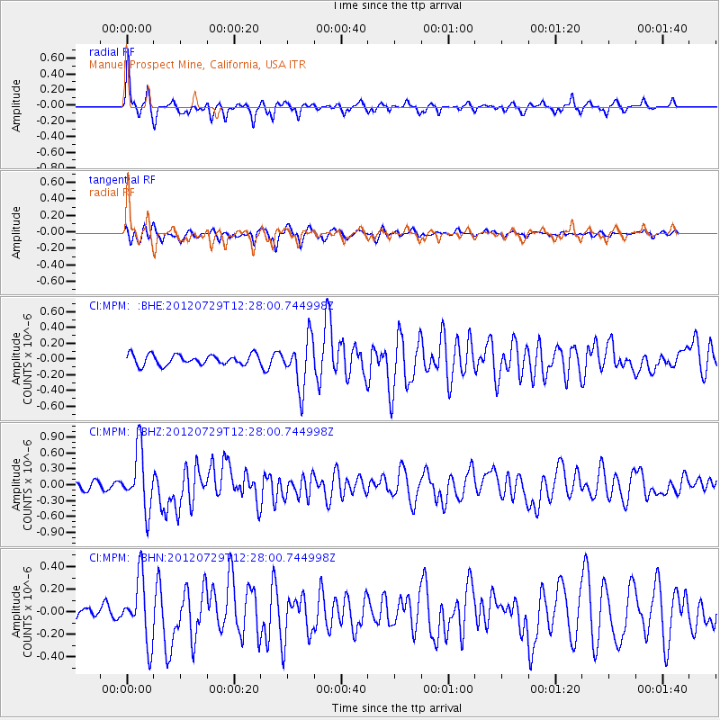
MPM Manuel Prospect Mine, California, USA - Earthquake Result Viewer
*The percent match for this event was below the threshold and hence no stack was calculated.
| Earthquake location: |
Near Coast Of Chiapas, Mexico |
| Earthquake latitude/longitude: |
14.2/-92.3 |
| Earthquake time(UTC): |
2012/07/29 (211) 12:22:11 GMT |
| Earthquake Depth: |
18 km |
| Earthquake Magnitude: |
5.6 MB, 5.5 MS, 5.9 MW, 5.8 MW |
| Earthquake Catalog/Contributor: |
WHDF/NEIC |
|
| Network: |
CI Caltech Regional Seismic Network |
| Station: |
MPM Manuel Prospect Mine, California, USA |
| Lat/Lon: |
36.06 N/117.49 W |
| Elevation: |
185 m |
|
| Distance: |
31.4 deg |
| Az: |
318.49 deg |
| Baz: |
127.507 deg |
| Ray Param: |
$rayparam |
*The percent match for this event was below the threshold and hence was not used in the summary stack. |
|
| Radial Match: |
74.407005 % |
| Radial Bump: |
284 |
| Transverse Match: |
73.132774 % |
| Transverse Bump: |
391 |
| SOD ConfigId: |
469095 |
| Insert Time: |
2013-02-22 02:30:18.794 +0000 |
| GWidth: |
2.5 |
| Max Bumps: |
400 |
| Tol: |
0.001 |
|
Signal To Noise
| Channel | StoN | STA | LTA |
| CI:MPM: :BHZ:20120729T12:28:00.744998Z | 9.306568 | 5.6470424E-7 | 6.067803E-8 |
| CI:MPM: :BHN:20120729T12:28:00.744998Z | 6.0414586 | 2.8202433E-7 | 4.6681496E-8 |
| CI:MPM: :BHE:20120729T12:28:00.744998Z | 4.830418 | 3.1299075E-7 | 6.4795785E-8 |
| Arrivals |
| Ps | |
| PpPs | |
| PsPs/PpSs | |


