TAM Tamanrasset, Algeria - Earthquake Result Viewer
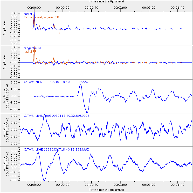
Earthquake location: Near Coast Of Oaxaca, Mexico
Earthquake latitude/longitude: 15.5/-94.7
Earthquake time(UTC): 1993/09/30 (273) 18:27:53 GMT
Earthquake Depth: 33 km
Earthquake Magnitude: 5.6 MB, 6.4 MS, 6.5 UNKNOWN, 6.7 MW
Earthquake Catalog/Contributor: WHDF/NEIC
Network: G GEOSCOPE
Station: TAM Tamanrasset, Algeria
Lat/Lon: 22.79 N/5.53 E
Elevation: 1377 m
Distance: 93.2 deg
Az: 65.447 deg
Baz: 288.161 deg
Ray Param: 0.041297704
Estimated Moho Depth: 34.5 km
Estimated Crust Vp/Vs: 1.73
Assumed Crust Vp: 6.61 km/s
Estimated Crust Vs: 3.832 km/s
Estimated Crust Poisson's Ratio: 0.25
Radial Match: 98.135605 %
Radial Bump: 274
Transverse Match: 75.04154 %
Transverse Bump: 400
SOD ConfigId: 16938
Insert Time: 2010-02-27 00:27:29.630 +0000
GWidth: 2.5
Max Bumps: 400
Tol: 0.001

Signal To Noise

ChannelStoNSTALTA
G:TAM: :BHN:19930930T18:40:32.898999Z2.85595548.7491514E-83.0634762E-8
G:TAM: :BHE:19930930T18:40:32.898999Z11.7183793.2489183E-72.7724981E-8
G:TAM: :BHZ:19930930T18:40:32.898999Z21.8442551.0020954E-64.587455E-8
Arrivals
Ps3.9 SECOND
PpPs14 SECOND
PsPs/PpSs18 SECOND