I05D Terrebonne, OR, USA - Earthquake Result Viewer
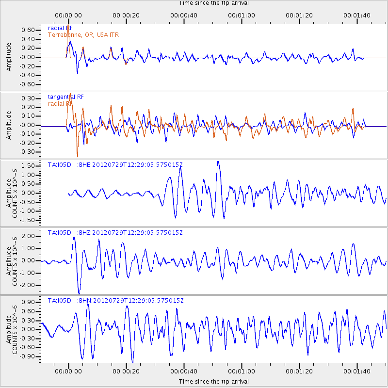
Earthquake location: Near Coast Of Chiapas, Mexico
Earthquake latitude/longitude: 14.2/-92.3
Earthquake time(UTC): 2012/07/29 (211) 12:22:11 GMT
Earthquake Depth: 18 km
Earthquake Magnitude: 5.6 MB, 5.5 MS, 5.9 MW, 5.8 MW
Earthquake Catalog/Contributor: WHDF/NEIC
Network: TA USArray Transportable Network (new EarthScope stations)
Station: I05D Terrebonne, OR, USA
Lat/Lon: 44.34 N/121.34 W
Elevation: 1546 m
Distance: 38.9 deg
Az: 326.316 deg
Baz: 131.442 deg
Ray Param: 0.075266875
Estimated Moho Depth: 14.25 km
Estimated Crust Vp/Vs: 1.61
Assumed Crust Vp: 6.597 km/s
Estimated Crust Vs: 4.104 km/s
Estimated Crust Poisson's Ratio: 0.18
Radial Match: 81.831795 %
Radial Bump: 396
Transverse Match: 74.08549 %
Transverse Bump: 400
SOD ConfigId: 469095
Insert Time: 2013-02-22 02:37:56.859 +0000
GWidth: 2.5
Max Bumps: 400
Tol: 0.001

Signal To Noise

ChannelStoNSTALTA
TA:I05D: :BHZ:20120729T12:29:05.575015Z15.4833821.3172215E-68.507324E-8
TA:I05D: :BHN:20120729T12:29:05.575015Z3.67367634.0839066E-71.1116675E-7
TA:I05D: :BHE:20120729T12:29:05.575015Z3.2358433.9790845E-71.2296903E-7
Arrivals
Ps1.4 SECOND
PpPs5.2 SECOND
PsPs/PpSs6.6 SECOND