D37A Cotton, MN, USA - Earthquake Result Viewer
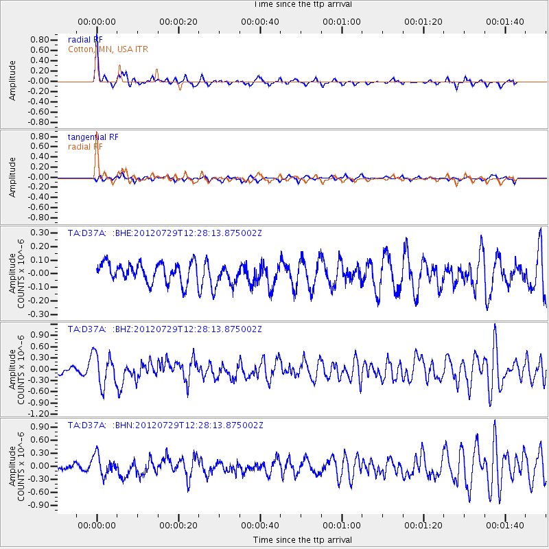
Earthquake location: Near Coast Of Chiapas, Mexico
Earthquake latitude/longitude: 14.2/-92.3
Earthquake time(UTC): 2012/07/29 (211) 12:22:11 GMT
Earthquake Depth: 18 km
Earthquake Magnitude: 5.6 MB, 5.5 MS, 5.9 MW, 5.8 MW
Earthquake Catalog/Contributor: WHDF/NEIC
Network: TA USArray Transportable Network (new EarthScope stations)
Station: D37A Cotton, MN, USA
Lat/Lon: 47.16 N/92.43 W
Elevation: 413 m
Distance: 32.9 deg
Az: 359.834 deg
Baz: 179.764 deg
Ray Param: 0.07845377
Estimated Moho Depth: 17.25 km
Estimated Crust Vp/Vs: 1.67
Assumed Crust Vp: 6.571 km/s
Estimated Crust Vs: 3.929 km/s
Estimated Crust Poisson's Ratio: 0.22
Radial Match: 81.24672 %
Radial Bump: 287
Transverse Match: 62.26084 %
Transverse Bump: 360
SOD ConfigId: 469095
Insert Time: 2013-02-22 02:40:03.678 +0000
GWidth: 2.5
Max Bumps: 400
Tol: 0.001

Signal To Noise

ChannelStoNSTALTA
TA:D37A: :BHZ:20120729T12:28:13.875002Z4.15802054.237739E-71.01917216E-7
TA:D37A: :BHN:20120729T12:28:13.875002Z2.05951382.3520101E-71.142022E-7
TA:D37A: :BHE:20120729T12:28:13.875002Z1.0140997.192495E-87.092498E-8
Arrivals
Ps1.9 SECOND
PpPs6.4 SECOND
PsPs/PpSs8.4 SECOND