C06D Leavenworth, WQ, USA - Earthquake Result Viewer
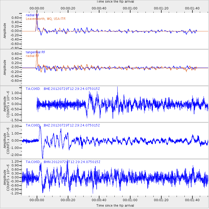
Earthquake location: Near Coast Of Chiapas, Mexico
Earthquake latitude/longitude: 14.2/-92.3
Earthquake time(UTC): 2012/07/29 (211) 12:22:11 GMT
Earthquake Depth: 18 km
Earthquake Magnitude: 5.6 MB, 5.5 MS, 5.9 MW, 5.8 MW
Earthquake Catalog/Contributor: WHDF/NEIC
Network: TA USArray Transportable Network (new EarthScope stations)
Station: C06D Leavenworth, WQ, USA
Lat/Lon: 47.92 N/120.89 W
Elevation: 544 m
Distance: 41.1 deg
Az: 330.704 deg
Baz: 135.123 deg
Ray Param: 0.07395314
Estimated Moho Depth: 37.25 km
Estimated Crust Vp/Vs: 1.72
Assumed Crust Vp: 6.597 km/s
Estimated Crust Vs: 3.83 km/s
Estimated Crust Poisson's Ratio: 0.25
Radial Match: 91.7905 %
Radial Bump: 400
Transverse Match: 84.989815 %
Transverse Bump: 400
SOD ConfigId: 469095
Insert Time: 2013-02-22 02:40:15.707 +0000
GWidth: 2.5
Max Bumps: 400
Tol: 0.001

Signal To Noise

ChannelStoNSTALTA
TA:C06D: :BHZ:20120729T12:29:24.075015Z9.8717061.1770209E-61.1923176E-7
TA:C06D: :BHN:20120729T12:29:24.075015Z2.20046625.153782E-72.3421319E-7
TA:C06D: :BHE:20120729T12:29:24.075015Z2.5384415.389176E-72.123026E-7
Arrivals
Ps4.4 SECOND
PpPs14 SECOND
PsPs/PpSs19 SECOND