H39A Augusta, WI, USA - Earthquake Result Viewer
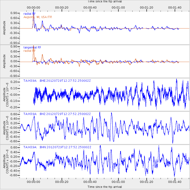
Earthquake location: Near Coast Of Chiapas, Mexico
Earthquake latitude/longitude: 14.2/-92.3
Earthquake time(UTC): 2012/07/29 (211) 12:22:11 GMT
Earthquake Depth: 18 km
Earthquake Magnitude: 5.6 MB, 5.5 MS, 5.9 MW, 5.8 MW
Earthquake Catalog/Contributor: WHDF/NEIC
Network: TA USArray Transportable Network (new EarthScope stations)
Station: H39A Augusta, WI, USA
Lat/Lon: 44.68 N/91.28 W
Elevation: 345 m
Distance: 30.4 deg
Az: 1.425 deg
Baz: 181.937 deg
Ray Param: 0.07933229
Estimated Moho Depth: 47.5 km
Estimated Crust Vp/Vs: 1.81
Assumed Crust Vp: 6.571 km/s
Estimated Crust Vs: 3.635 km/s
Estimated Crust Poisson's Ratio: 0.28
Radial Match: 88.416046 %
Radial Bump: 340
Transverse Match: 67.82263 %
Transverse Bump: 400
SOD ConfigId: 469095
Insert Time: 2013-02-22 02:41:33.067 +0000
GWidth: 2.5
Max Bumps: 400
Tol: 0.001

Signal To Noise

ChannelStoNSTALTA
TA:H39A: :BHZ:20120729T12:27:52.250002Z3.7649522.9715417E-77.892642E-8
TA:H39A: :BHN:20120729T12:27:52.250002Z2.8185372.1887399E-77.765518E-8
TA:H39A: :BHE:20120729T12:27:52.250002Z0.67320433.453735E-85.1302926E-8
Arrivals
Ps6.3 SECOND
PpPs19 SECOND
PsPs/PpSs25 SECOND