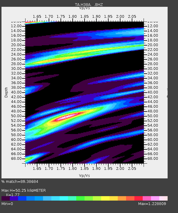
H38A Maiden Rock, WI, USA - Earthquake Result Viewer
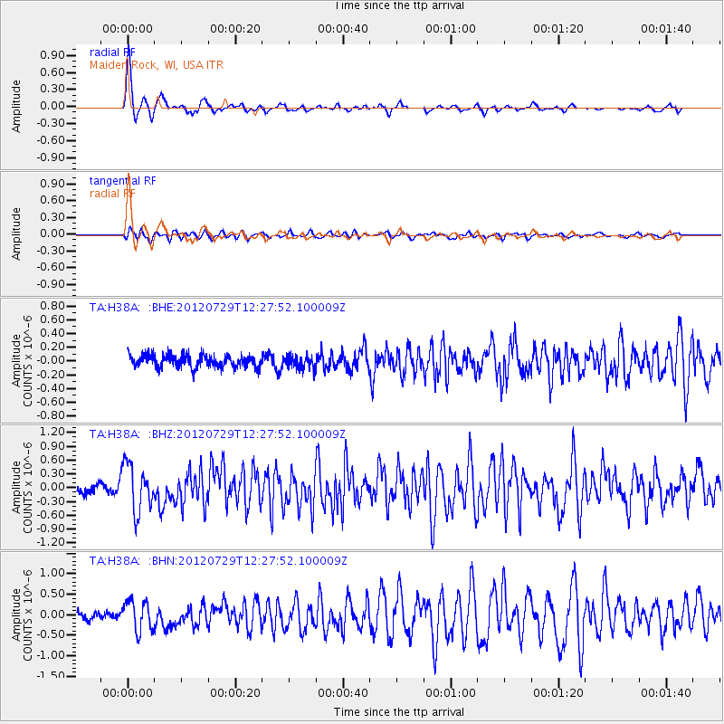
Earthquake location: Near Coast Of Chiapas, Mexico
Earthquake latitude/longitude: 14.2/-92.3
Earthquake time(UTC): 2012/07/29 (211) 12:22:11 GMT
Earthquake Depth: 18 km
Earthquake Magnitude: 5.6 MB, 5.5 MS, 5.9 MW, 5.8 MW
Earthquake Catalog/Contributor: WHDF/NEIC
Network: TA USArray Transportable Network (new EarthScope stations)
Station: H38A Maiden Rock, WI, USA
Lat/Lon: 44.68 N/92.28 W
Elevation: 333 m
Distance: 30.4 deg
Az: 0.017 deg
Baz: 180.023 deg
Ray Param: 0.07933665
Estimated Moho Depth: 50.25 km
Estimated Crust Vp/Vs: 1.77
Assumed Crust Vp: 6.571 km/s
Estimated Crust Vs: 3.712 km/s
Estimated Crust Poisson's Ratio: 0.27
Radial Match: 89.38684 %
Radial Bump: 350
Transverse Match: 67.63382 %
Transverse Bump: 400
SOD ConfigId: 469095
Insert Time: 2013-02-22 02:41:34.349 +0000
GWidth: 2.5
Max Bumps: 400
Tol: 0.001

Signal To Noise

ChannelStoNSTALTA
TA:H38A: :BHZ:20120729T12:27:52.100009Z6.205335.1415407E-78.285685E-8
TA:H38A: :BHN:20120729T12:27:52.100009Z4.14281563.7167976E-78.971671E-8
TA:H38A: :BHE:20120729T12:27:52.100009Z1.04921989.408293E-88.966941E-8
Arrivals
Ps6.4 SECOND
PpPs19 SECOND
PsPs/PpSs26 SECOND