You are here: Home > Network List > TA - USArray Transportable Network (new EarthScope stations) Stations List
> Station G40A Rib Lake, WI, USA > Earthquake Result Viewer
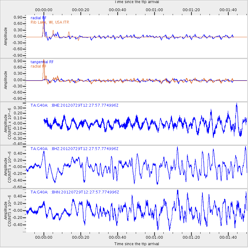
G40A Rib Lake, WI, USA - Earthquake Result Viewer
*The percent match for this event was below the threshold and hence no stack was calculated.
| Earthquake location: |
Near Coast Of Chiapas, Mexico |
| Earthquake latitude/longitude: |
14.2/-92.3 |
| Earthquake time(UTC): |
2012/07/29 (211) 12:22:11 GMT |
| Earthquake Depth: |
18 km |
| Earthquake Magnitude: |
5.6 MB, 5.5 MS, 5.9 MW, 5.8 MW |
| Earthquake Catalog/Contributor: |
WHDF/NEIC |
|
| Network: |
TA USArray Transportable Network (new EarthScope stations) |
| Station: |
G40A Rib Lake, WI, USA |
| Lat/Lon: |
45.27 N/90.20 W |
| Elevation: |
472 m |
|
| Distance: |
31.0 deg |
| Az: |
2.869 deg |
| Baz: |
183.941 deg |
| Ray Param: |
$rayparam |
*The percent match for this event was below the threshold and hence was not used in the summary stack. |
|
| Radial Match: |
79.967606 % |
| Radial Bump: |
387 |
| Transverse Match: |
61.77845 % |
| Transverse Bump: |
400 |
| SOD ConfigId: |
469095 |
| Insert Time: |
2013-02-22 02:41:56.526 +0000 |
| GWidth: |
2.5 |
| Max Bumps: |
400 |
| Tol: |
0.001 |
|
Signal To Noise
| Channel | StoN | STA | LTA |
| TA:G40A: :BHZ:20120729T12:27:57.774996Z | 3.3523796 | 2.4372116E-7 | 7.270094E-8 |
| TA:G40A: :BHN:20120729T12:27:57.774996Z | 2.5213327 | 1.3274314E-7 | 5.2648005E-8 |
| TA:G40A: :BHE:20120729T12:27:57.774996Z | 1.105341 | 6.884112E-8 | 6.2280435E-8 |
| Arrivals |
| Ps | |
| PpPs | |
| PsPs/PpSs | |


