
G43A Wallace, MI, USA - Earthquake Result Viewer
| ||||||||||||||||||
| ||||||||||||||||||
| ||||||||||||||||||
|
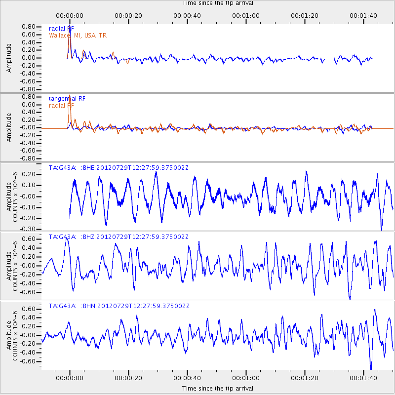
Signal To Noise
| Channel | StoN | STA | LTA |
| TA:G43A: :BHZ:20120729T12:27:59.375002Z | 3.2848003 | 3.5034705E-7 | 1.0665703E-7 |
| TA:G43A: :BHN:20120729T12:27:59.375002Z | 1.888106 | 1.4400764E-7 | 7.627095E-8 |
| TA:G43A: :BHE:20120729T12:27:59.375002Z | 1.1121153 | 1.2499912E-7 | 1.1239763E-7 |
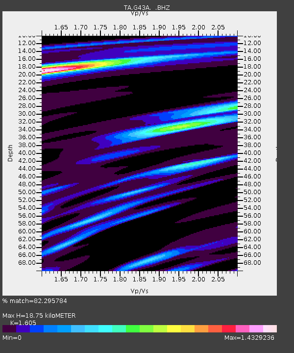
| Arrivals | |
| Ps | 1.9 SECOND |
| PpPs | 6.8 SECOND |
| PsPs/PpSs | 8.7 SECOND |

