MRBL Marblemount, WA, USA - Earthquake Result Viewer
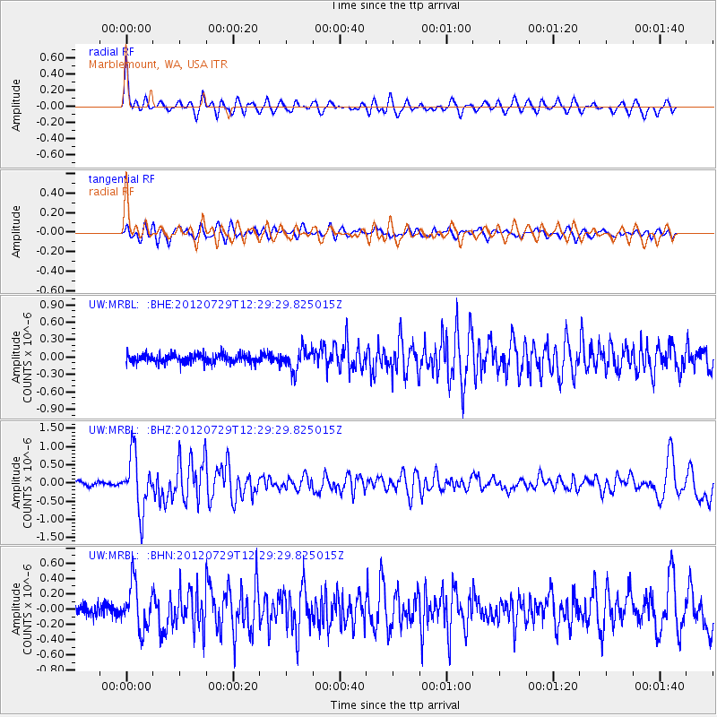
Earthquake location: Near Coast Of Chiapas, Mexico
Earthquake latitude/longitude: 14.2/-92.3
Earthquake time(UTC): 2012/07/29 (211) 12:22:11 GMT
Earthquake Depth: 18 km
Earthquake Magnitude: 5.6 MB, 5.5 MS, 5.9 MW, 5.8 MW
Earthquake Catalog/Contributor: WHDF/NEIC
Network: UW Pacific Northwest Regional Seismic Network
Station: MRBL Marblemount, WA, USA
Lat/Lon: 48.52 N/121.48 W
Elevation: 75 m
Distance: 41.8 deg
Az: 330.919 deg
Baz: 134.845 deg
Ray Param: 0.07350998
Estimated Moho Depth: 23.0 km
Estimated Crust Vp/Vs: 1.95
Assumed Crust Vp: 6.566 km/s
Estimated Crust Vs: 3.372 km/s
Estimated Crust Poisson's Ratio: 0.32
Radial Match: 80.82693 %
Radial Bump: 400
Transverse Match: 70.5165 %
Transverse Bump: 400
SOD ConfigId: 469095
Insert Time: 2013-02-22 02:45:35.509 +0000
GWidth: 2.5
Max Bumps: 400
Tol: 0.001

Signal To Noise

ChannelStoNSTALTA
UW:MRBL: :BHZ:20120729T12:29:29.825015Z12.9085047.674377E-75.9452105E-8
UW:MRBL: :BHN:20120729T12:29:29.825015Z4.77084642.9876466E-76.262299E-8
UW:MRBL: :BHE:20120729T12:29:29.825015Z2.49277421.8353413E-77.362645E-8
Arrivals
Ps3.5 SECOND
PpPs9.7 SECOND
PsPs/PpSs13 SECOND