You are here: Home > Network List > CN - Canadian National Seismograph Network Stations List
> Station INK INUVIK, NT > Earthquake Result Viewer
INK INUVIK, NT - Earthquake Result Viewer
*The percent match for this event was below the threshold and hence no stack was calculated.
| Earthquake location: |
Near N Coast Of New Guinea, P.N.G. |
| Earthquake latitude/longitude: |
-4.4/144.6 |
| Earthquake time(UTC): |
2012/08/01 (214) 20:43:40 GMT |
| Earthquake Depth: |
49 km |
| Earthquake Magnitude: |
5.6 MB, 5.4 MW |
| Earthquake Catalog/Contributor: |
WHDF/NEIC |
|
| Network: |
CN Canadian National Seismograph Network |
| Station: |
INK INUVIK, NT |
| Lat/Lon: |
68.31 N/133.53 W |
| Elevation: |
44 m |
|
| Distance: |
91.0 deg |
| Az: |
21.597 deg |
| Baz: |
260.808 deg |
| Ray Param: |
$rayparam |
*The percent match for this event was below the threshold and hence was not used in the summary stack. |
|
| Radial Match: |
54.033043 % |
| Radial Bump: |
400 |
| Transverse Match: |
49.93081 % |
| Transverse Bump: |
400 |
| SOD ConfigId: |
469095 |
| Insert Time: |
2013-02-22 02:49:52.624 +0000 |
| GWidth: |
2.5 |
| Max Bumps: |
400 |
| Tol: |
0.001 |
|
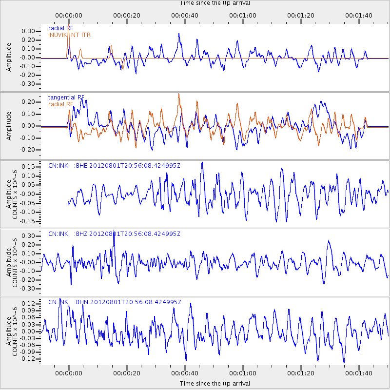
Signal To Noise
| Channel | StoN | STA | LTA |
| CN:INK: :BHZ:20120801T20:56:08.424995Z | 1.3439245 | 7.728165E-8 | 5.750445E-8 |
| CN:INK: :BHN:20120801T20:56:08.424995Z | 1.8500184 | 8.6374484E-8 | 4.6688445E-8 |
| CN:INK: :BHE:20120801T20:56:08.424995Z | 1.6906089 | 6.000966E-8 | 3.5495887E-8 |
| Arrivals |
| Ps | |
| PpPs | |
| PsPs/PpSs | |


