You are here: Home > Network List > G - GEOSCOPE Stations List
> Station TAM Tamanrasset, Algeria > Earthquake Result Viewer
TAM Tamanrasset, Algeria - Earthquake Result Viewer

| Earthquake location: |
Afghanistan-Tajikistan Bord Reg. |
| Earthquake latitude/longitude: |
36.3/71.1 |
| Earthquake time(UTC): |
1994/06/30 (181) 09:23:21 GMT |
| Earthquake Depth: |
233 km |
| Earthquake Magnitude: |
6.1 MB, 6.4 UNKNOWN, 6.2 MW |
| Earthquake Catalog/Contributor: |
WHDF/NEIC |
|
| Network: |
G GEOSCOPE |
| Station: |
TAM Tamanrasset, Algeria |
| Lat/Lon: |
22.79 N/5.53 E |
| Elevation: |
1377 m |
|
| Distance: |
57.6 deg |
| Az: |
275.878 deg |
| Baz: |
60.609 deg |
| Ray Param: |
0.06258903 |
| Estimated Moho Depth: |
40.75 km |
| Estimated Crust Vp/Vs: |
1.60 |
| Assumed Crust Vp: |
6.61 km/s |
| Estimated Crust Vs: |
4.131 km/s |
| Estimated Crust Poisson's Ratio: |
0.18 |
|
| Radial Match: |
95.889435 % |
| Radial Bump: |
244 |
| Transverse Match: |
84.28766 % |
| Transverse Bump: |
400 |
| SOD ConfigId: |
16938 |
| Insert Time: |
2010-02-27 00:28:02.039 +0000 |
| GWidth: |
2.5 |
| Max Bumps: |
400 |
| Tol: |
0.001 |
|
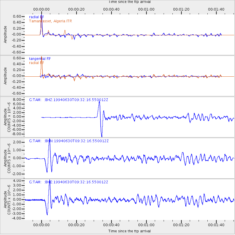
Signal To Noise
| Channel | StoN | STA | LTA |
| G:TAM: :BHN:19940630T09:32:16.550012Z | 17.174574 | 1.0340787E-6 | 6.0209864E-8 |
| G:TAM: :BHE:19940630T09:32:16.550012Z | 33.91865 | 1.7547475E-6 | 5.1734E-8 |
| G:TAM: :BHZ:19940630T09:32:16.550012Z | 79.003914 | 4.176297E-6 | 5.2861896E-8 |
| Arrivals |
| Ps | 3.9 SECOND |
| PpPs | 15 SECOND |
| PsPs/PpSs | 19 SECOND |


